
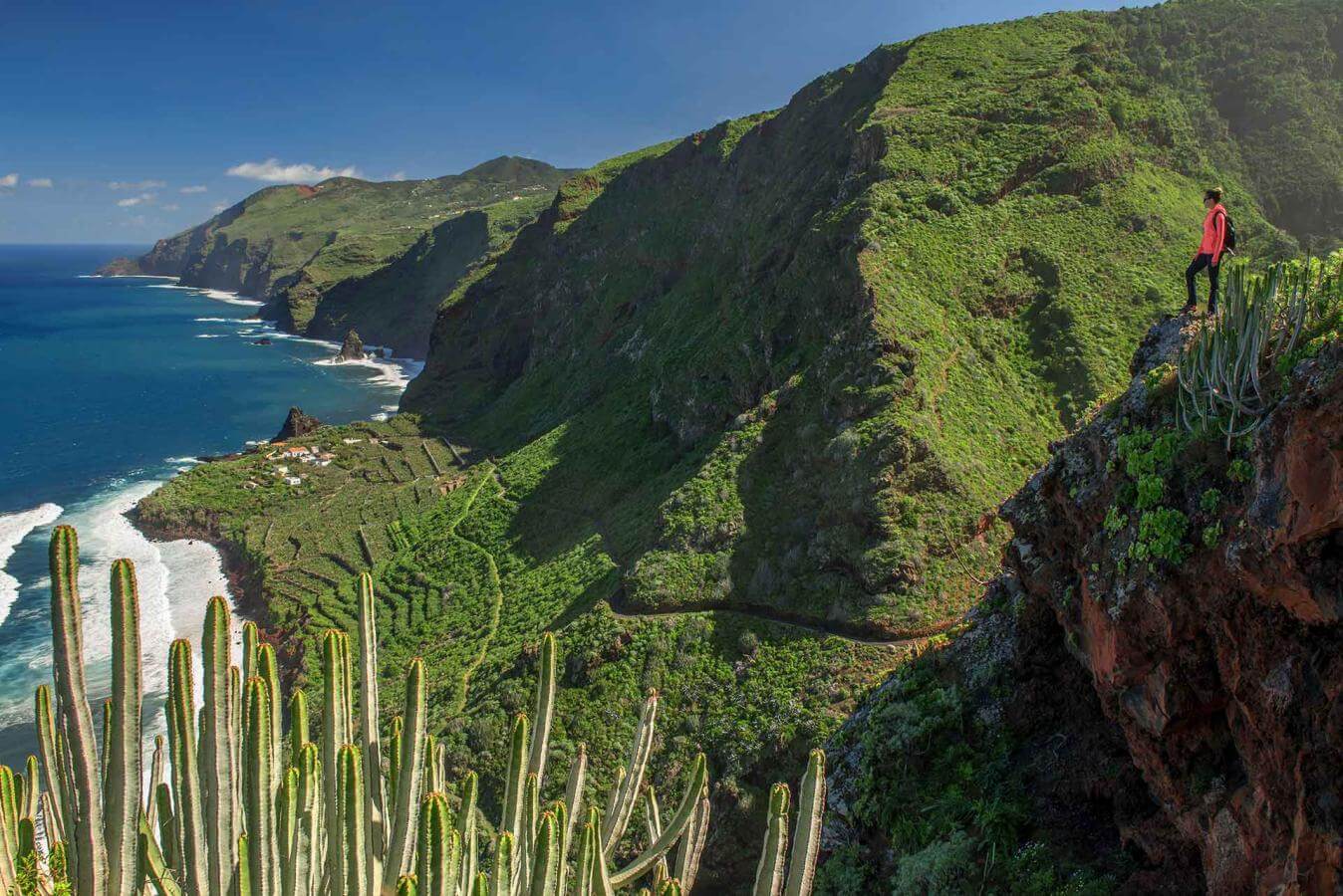
The island of La Palma is a unique destination for professional and amateur photographers who find an ideal place for creativity in its diversity of landscapes. The light of Isla Bonita, its protected landscapes, its famous Sea of Clouds or any of the trails that run between its volcanoes are a precious treasure for capturing with the lens, turning each snapshot into a memorable souvenir.
A Sea of Clouds and a Village in a Cave
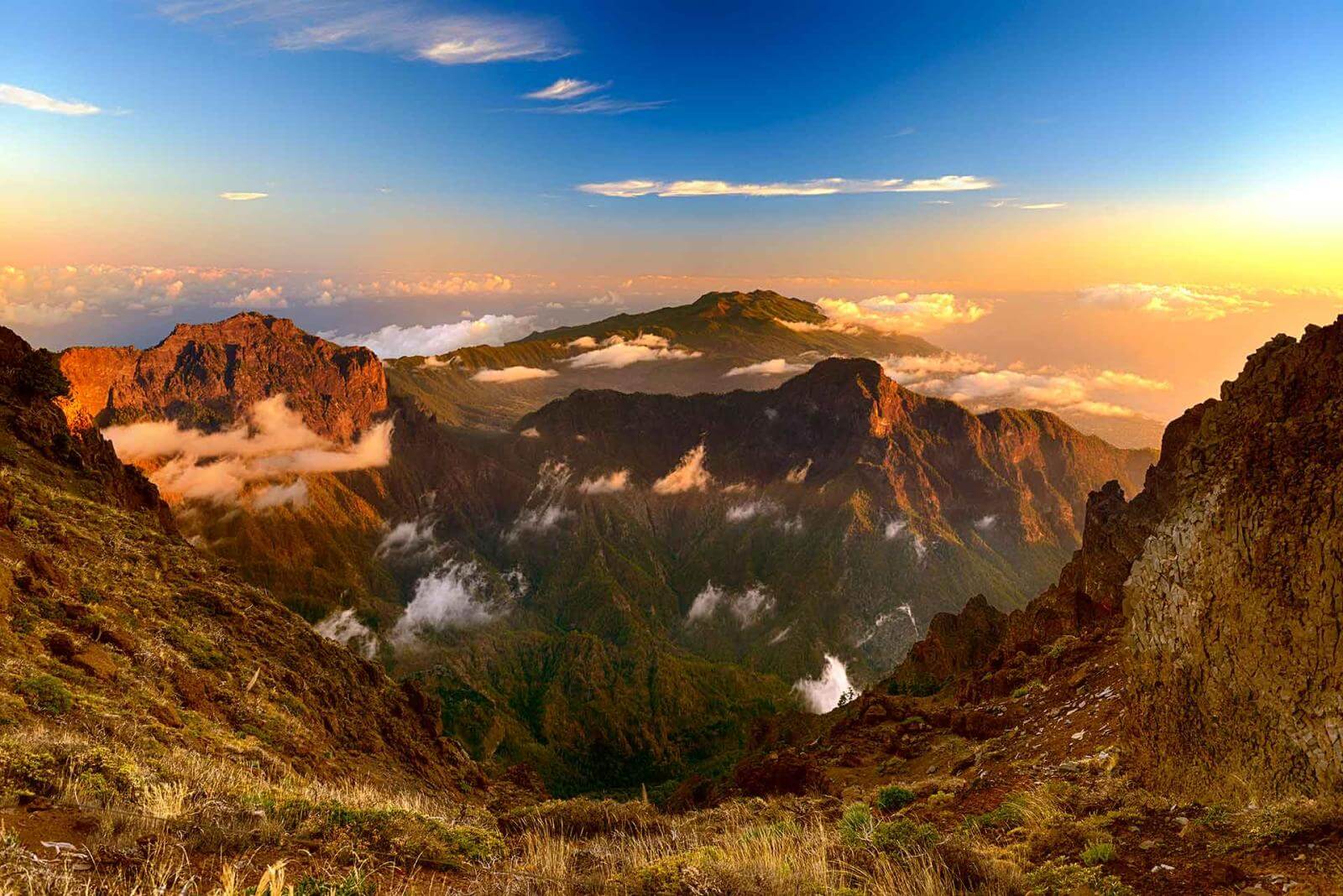
Recognized by UNESCO as a Biosphere Reserve, the island of La Palma has unique natural phenomena, such as its famous Sea of Clouds, which extends like a carpet below Roque de los Muchachos. The trade winds are responsible for this phenomenon that can be photographed in the summits of the island, which are many; from Bejenao or the road to La Cumbre, in El Paso, to El Roque de Los Muchachos, in Garafía.
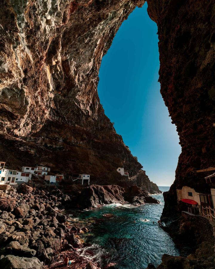
Another unique place on the island is the well-known village of Porís de Candelaria, in the municipality of Tijarafe. This group of houses hidden in a cave presents a challenge for the most experienced photographers, as access is not easy. To photograph it, it is best to stand at the last curve of the path that leads to the cave or, once inside the cave, to seek the focus inside the huge oval of rock where the Porís is located. This view is achieved by being very close to the bottom.
El Mirador de los Llanos del Jable y La Cumbrecita are very close to La Caldera de Taburiente National Park.. They belong to the municipality of El Paso, and from there you can photograph the mountainous profile of that side of the caldera.


Route of the Volcanoes: Teneguía, San Antonio and Tajogaite
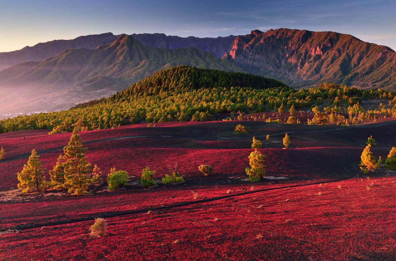
Nature turned La Palma into the center of attention when the new volcano of La Palma erupted in the area known as Cumbre Vieja. Through its different vents, it expelled lava for three months over the municipalities of Los Llanos de Aridane, El Paso and Tazacorte. The crater remains in the neighborhood of Las Manchas, still with sulfur in its upper part, from this spectacular volcano with a height of 1,120 meters. Authorized tour companies can take photographers very close to the area. The best images can be captured along this route.
The Fuencaliente Lighthouse and the Fuencaliente Salt Flats are very close to the Teneguía and San Antonio volcanoes. The sea and the volcanic lava form a landscape in which, especially near the coast, the salt and the different shades of lava show a photographic route that contrasts with the greenery of the rest of the island.

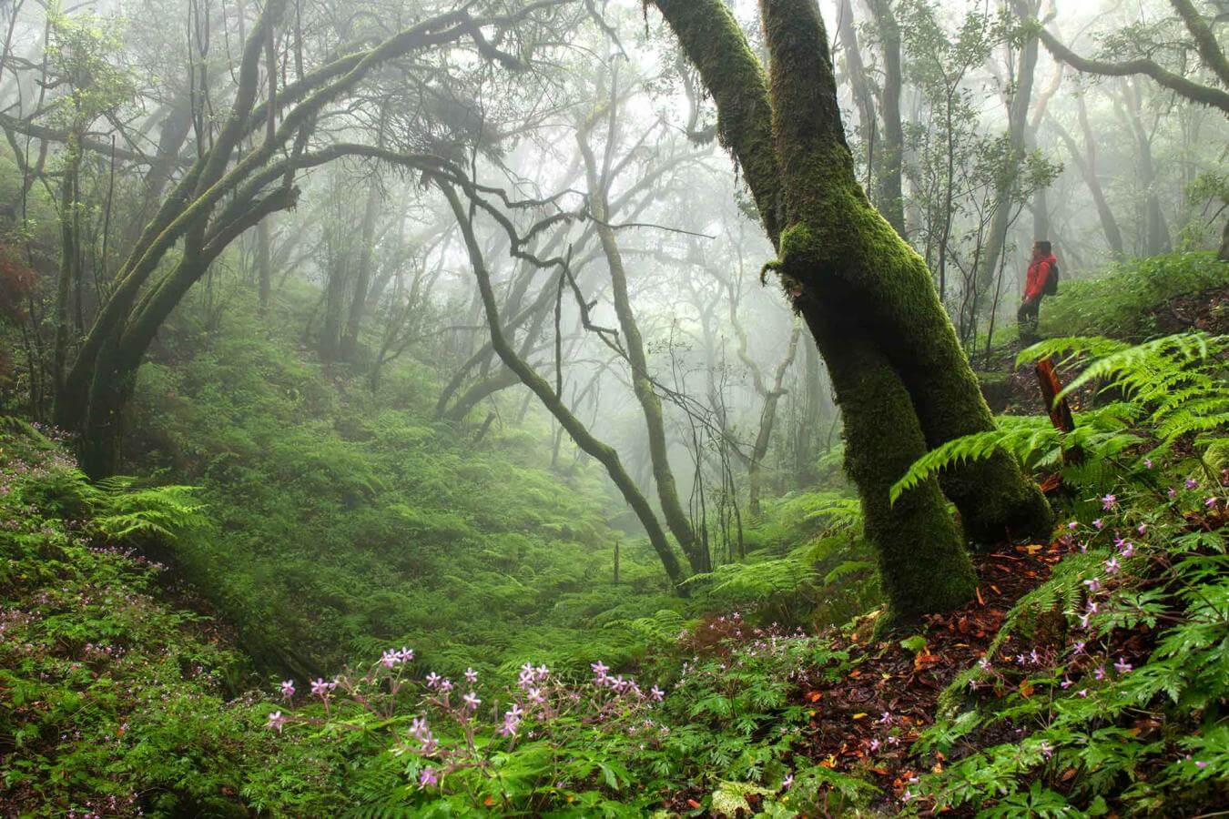

Ancient Forests, Laurel Forests and Colorful Waterfalls
Inside La Caldera de Taburiente all the trails, where the water seeps through the rocks covering them with green moss and pine forests, lead to the to the Caldera River. This is a river that in its lower flow area crosses ferrous rocks, offering a unique photograph of the impressive Cascada de Colores (colorful waterfall).
Los Tilos and its water viaduct are located over the ravine of San Andrés y Sauces, so the waterfalls of up to 30 meters and its laurel forest offer a whole day of photographs, a delight for those who want to portray nature in all its splendor.
The laurel forest is also found in Cubo de la Galga, a ravine located on the northeastern slope of La Palma, between the municipalities of Puntallana and San Andrés. Another good option is the Caldera del Agua in Villa de Garafía, under the Parque Cultural de la Zarza y la Zarcita.
The Tajinastes in bloom, in the area of the Roque de los Muchachos on the summits of Garafía, takes place around the month of May-June (almost coinciding with another no less amazing spectacle, which is the flowering of the codeso, gorse and shrub), promising an otherworldly landscape. Depending on the focus of the camera, the place looks different. This species is native to the Canary Islands and blooms with blue, violet colors in its cones, which point to the sky to show all its beauty.
Thus, the tour through the landscapes and municipalities of La Isla Bonita offers a thousand and one unique images for the eye of a photographer.