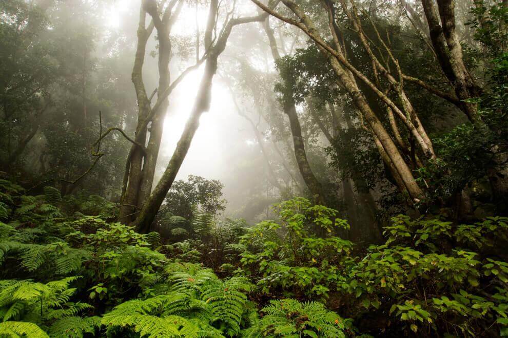
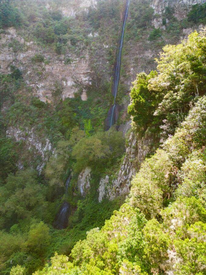
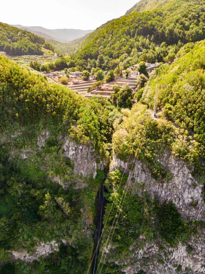
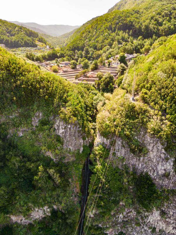
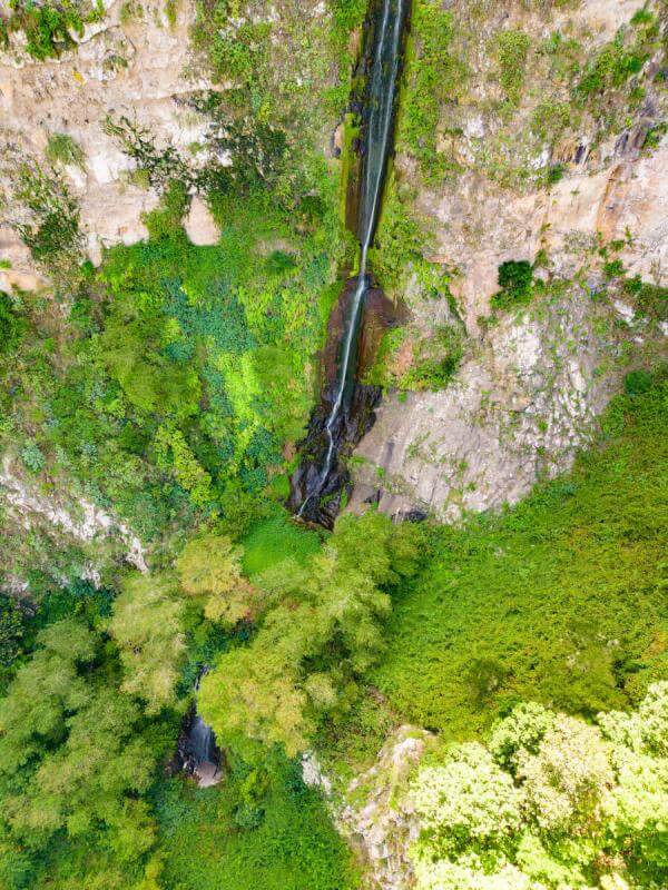
This route is the longest and one of the most varied in Garajonay National Park. Over the course of its nearly thirteen kilometres, visitors cross an extraordinary diversity of landscapes, ecosystems, and geological features, making this trail a perfect compendium of the Park’s natural richness. The itinerary begins at Pajarito, first traversing the Park’s summits, where summit heathlands dominate. In these elevated environments, the ground is covered with dense carpets of mosses and lichens, while the humid and cool air—especially on misty days—gives the surroundings a mysterious and silent character. The trail then descends along the northern slope, entering the lush and humid hillside laurel forest, one of the Park’s most emblematic ecosystems. Further down, in the ravine bottoms, visitors pass through areas dominated by laurel forest with viñátigos, where these trees often reach remarkable size thanks to the abundant water availability. Permanent streams, small waterfalls, and the constant sound of flowing water accompany much of the route toward El Chorro del Cedro, one of the most attractive and popular highlights of the itinerary. The route continues toward Tajaqué, opening onto forest landscapes that alternate between dense monteverde stands and more open areas offering wide panoramic views of the lower parts of the island. The contrast between the humid northern environments and the drier, sunnier southern areas makes this section particularly rich in diversity. Among the most remarkable geological landmarks along the route is the Los Roques area, a monumental group of phonolitic volcanic plugs that dominate the central landscape of La Gomera. Nearby, of great geomorphological interest, are the horizontal basalt formations in the Benchijigua caldera, spectacular volcanic stratifications that help explain the island’s complex geological history. In this final sector, it is possible to observe uncommon species, including the Canary Island juniper (Juniperus cedrus) and the blue tajinaste, botanical treasures of La Gomera’s highlands that find some of their most favourable habitats here. After completing the large northern and eastern arc of the route, the trail ascends once again toward Pajarito, closing a long, demanding, and deeply rewarding itinerary that encapsulates the full landscape, botanical, and geological diversity of Garajonay National Park.