Orienteering map of El Riachuelo

Orienteering at the Caldera de Taburiente

After a can't-miss visit to the information centre at the Caldera de Taburiente National Park and enjoying the impressive views from the Cumbrecita Viewing Point, we start the map at the recommended point for a day's orienteering through the thick pine forest in the north of La Palma. Continuing along a few kilometres of road to El Paso, we find all the necessary services.

La Palma and its pine forests

This map provides a variety of terrains and technical components. A characteristic pine forest that is very easy to cross but has a moderate elevation variance leads to open areas with low vegetation, where we discover low walls from crop-farming, water channels and traditional irrigation methods. This route, which you can combine with visiting the information centre at the Caldera de Taburiente, lets you understand some of the main natural features of La Palma, which have conditioned and modelled the traditional customs of settlers here.

Parking
Localidad
El Paso
Downloadable files selection
Archivos
Imagen Archivo
Título Fichero
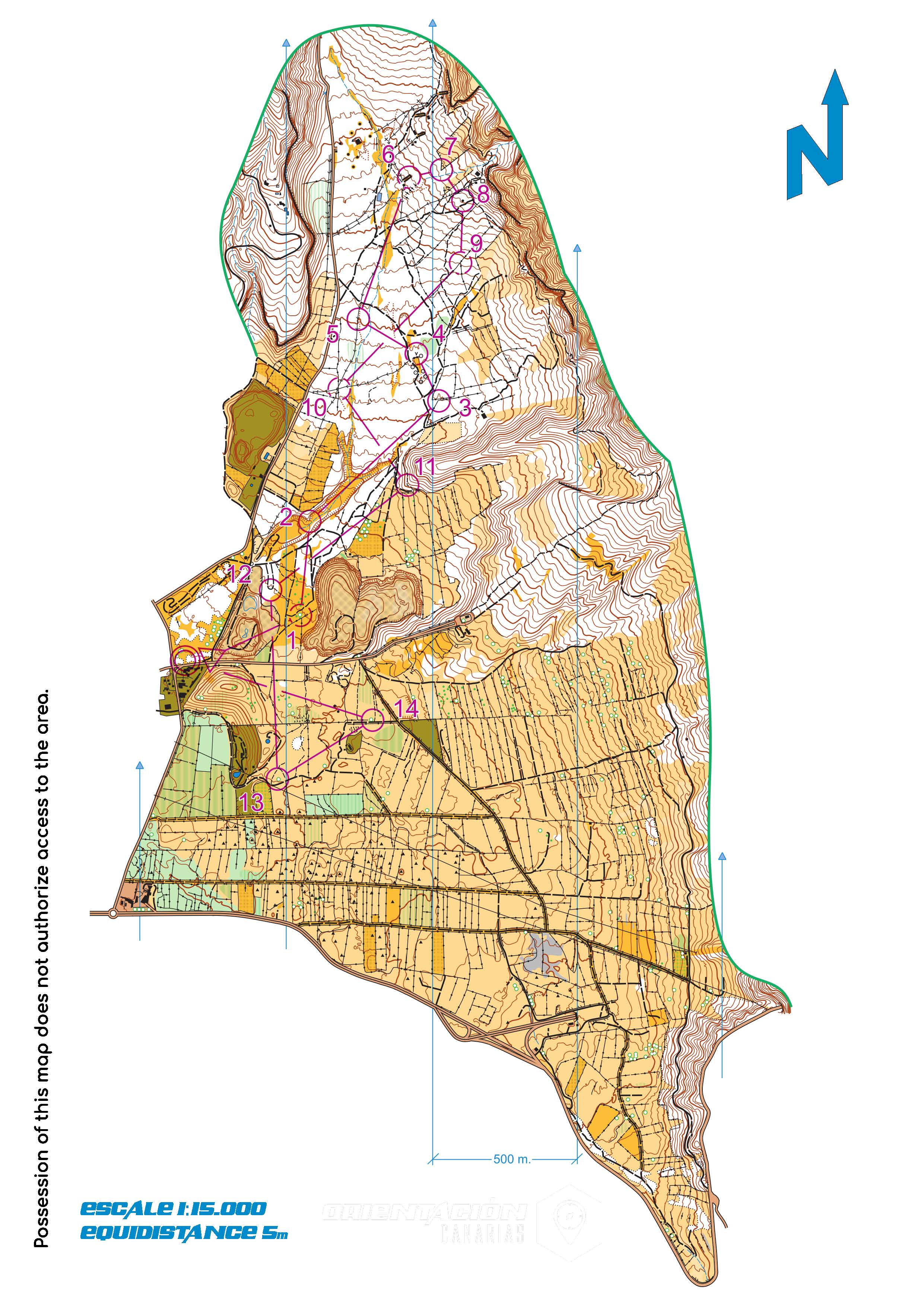
Mapa El Riachuelo orientación de La Palma
jpg

TENERIFE

TENERIFE

GRAN CANARIA

GRAN CANARIA

FUERTEVENTURA

FUERTEVENTURA

LANZAROTE

LANZAROTE

LA GRACIOSA

LA GRACIOSA

LA GOMERA

LA GOMERA

LA PALMA

LA PALMA

EL HIERRO

EL HIERRO
Sustainability
Sostenibilidad
- Never leave waste of any kind in the environment, including cigarette butts. Food scraps contribute to the proliferation of rodents and feral cats that pose a serious threat to wildlife.
- Respect the animals, do not disturb or feed them. If you see any injured specimen, you can call the emergency telephone number 112. Do not pick flowers or plants either.
- Do not collect or take stones or any other element of the natural environment. Do not modify it either by stacking them to make the sadly famous "towers."
- Do not practice sports activities outside the permitted areas.
5
257
13
262
10045