


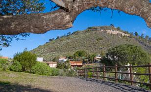
The pathway starts from a group of houses, which in some cases maintain the traditional typology, including a wine cellar which situates us in a landscape marked by vines and the world of wine.
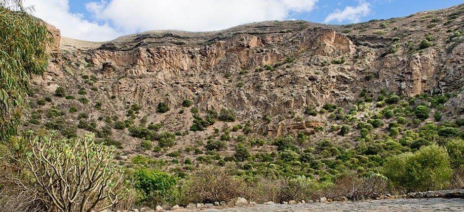
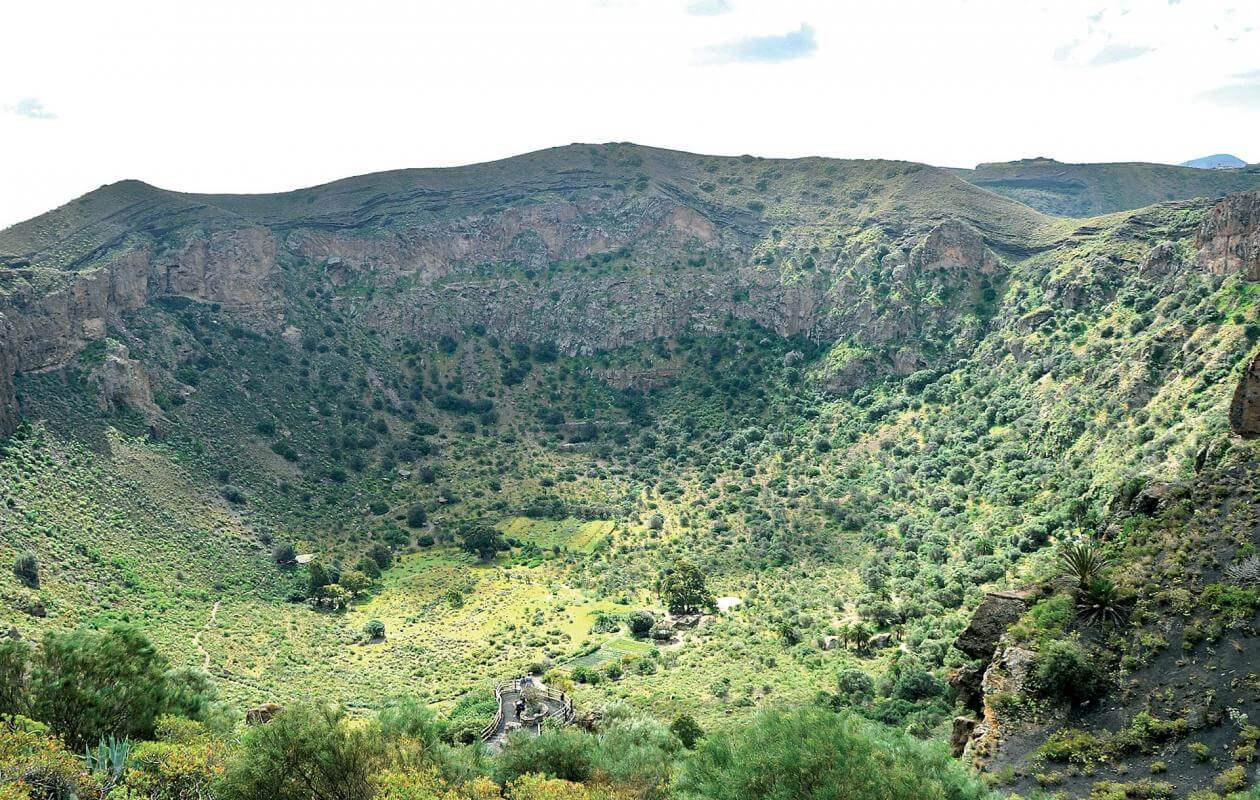
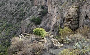
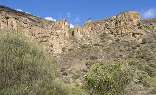
We come across this viewpoint when we start our trek along the footpath on the left of a small flatland. It gives us a panoramic view of the inside of the crater and its walls; it is an excellent observatory to appreciate the geological diversity of the crater. On the left, among the most important elements, on the slope of the peak of Bandama, is a deposit of fluids in an interior area of the crater, which we recognize as a set of horizontal layers on a 50 metre stretch in an irregular triangular shape.
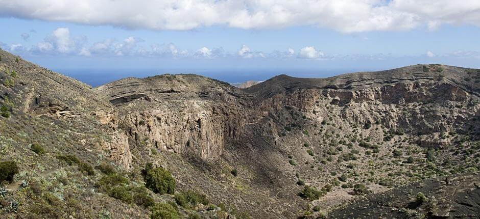
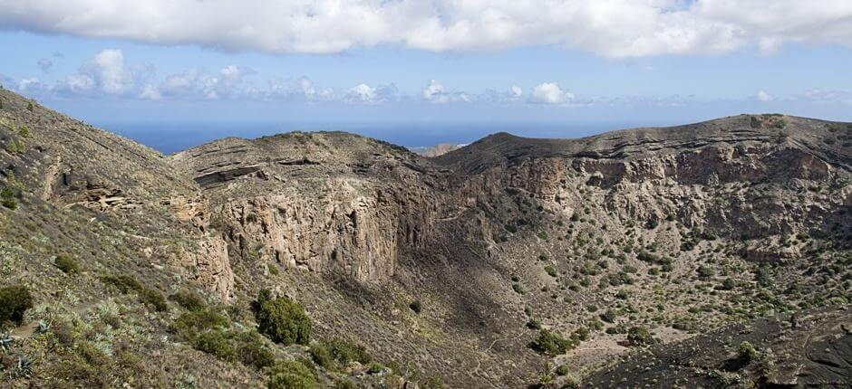
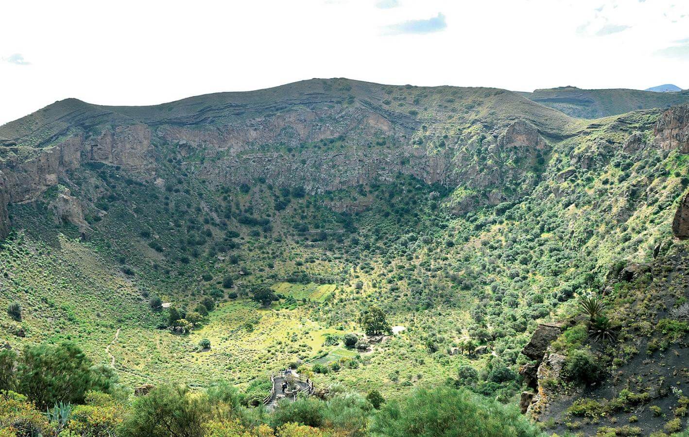
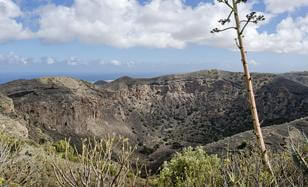
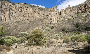
This viewpoint above a rocky protrusion is at a height of 380 metres and from it we see the whole crater. From here we see the rings of rocky layers which make up the walls of the crater. We clearly distinguish the different areas at the bottom, zones where remains of agricultural work are to be seen as well as the thermophilic forest, which is taking up more space, thus regaining lost terrain.
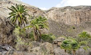
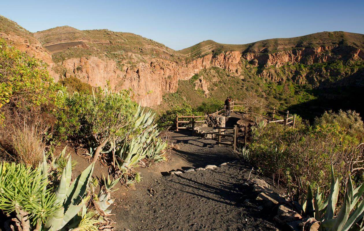
We go through an area in which the ground goes from volcanic gravel in the first part to scree on the slopes. We go into an area where a thermophilic forest of mastic, wild olive and palm trees mixes with large rocky boulders which have fallen from the crag thus lending its name to the area.
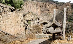
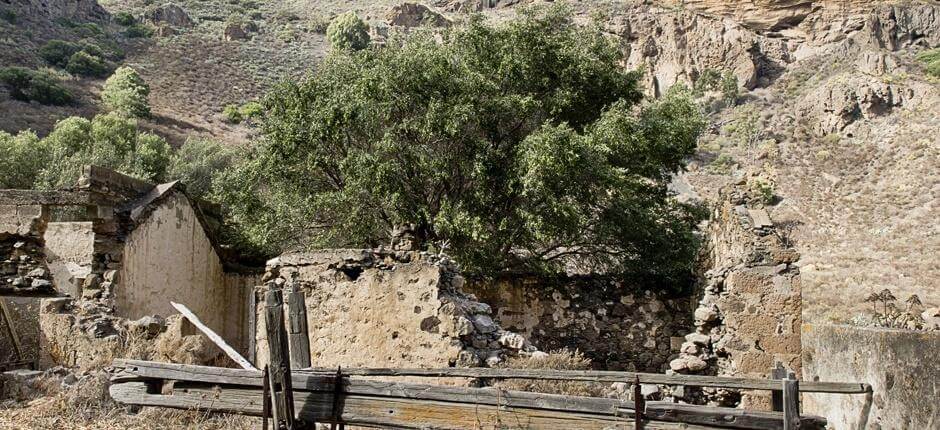
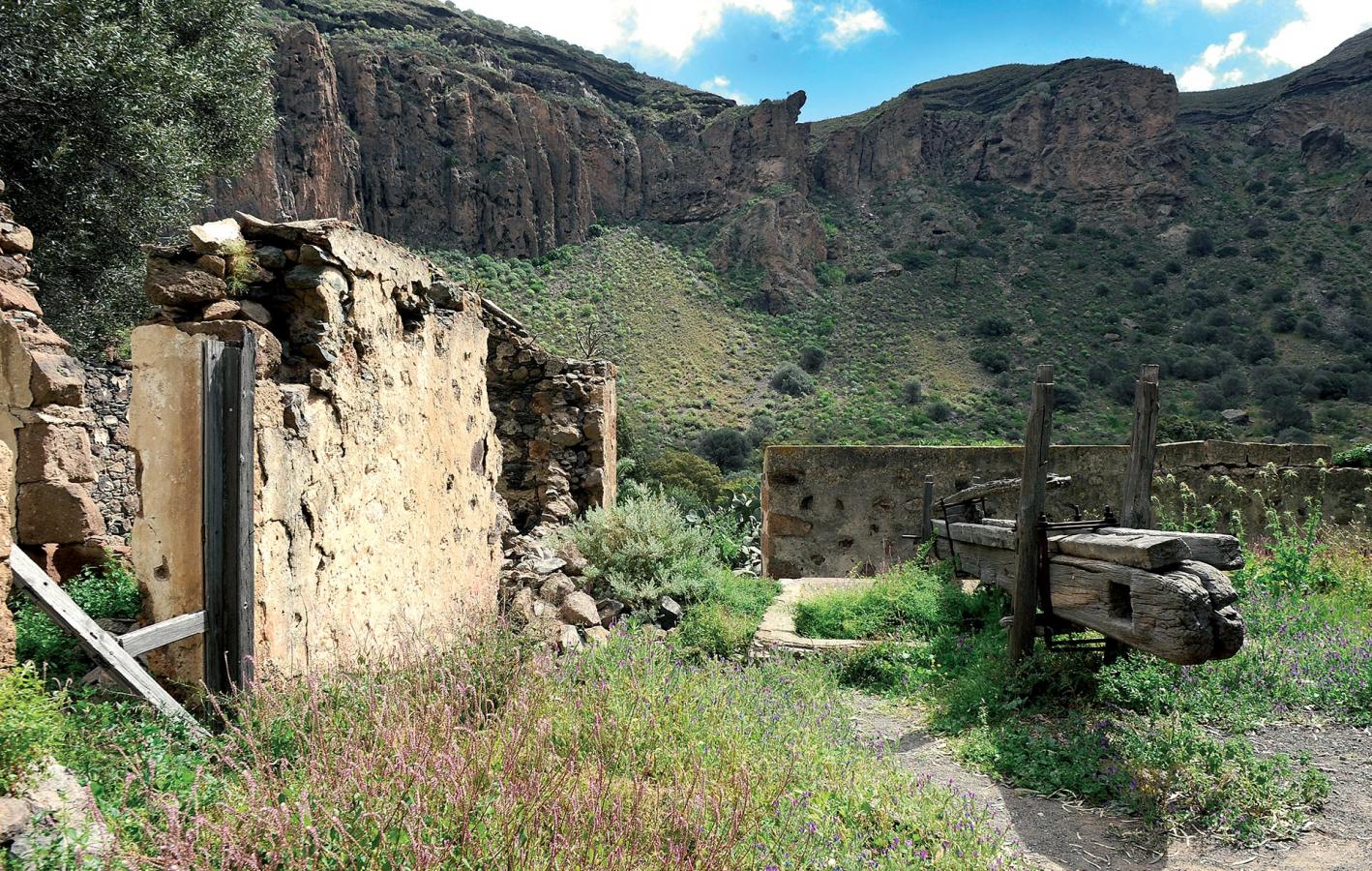
This half ruined hamlet takes us back to the first colonist of the crater, Daniel Van Damme, in the XVI century, and whose name it takes. The hamlet is made up of an L shaped house cellar with a wine press, one of the oldest in Gran Canaria, a barn for animals, a threshing floor and oven.
From Casas del Fondo we take the circular path which will lead us to all corners of the crater; we leave behind the house of the crater’s last labourer, Agustinito. We pass by a pond with a bird watching observatory and then we get to the barn’s threshing floor, opposite Casas del Fondo, above El Natero, name of the central part of the crater, the crater has three threshing floors which gives an idea of how important cereal growing was in the area.
On the southeast side of the crater, we go through a beautiful thermophilic forest with wild olive, mastic, palm and dragon trees which grow along the slopes up to the crag. In this area is the only source of water in the crater which is channeled to a simple tap in Casas del Fondo. Before making our way back along the slope we stop to appreciate the silence of the crater and absorb ourselves in nature as the impressive vertical walls isolate us from the world outside.
- Never leave waste of any type lying around, including cigarette butts. Leftover food leads to a proliferation of rats and wild cats, which pose a serious threat to the fauna.
- Respect the animals. Do not bother them or feed them. If you see an injured specimen, you can call the emergency number: 112. Do not pick flowers or plants.
- Do not pick up or take away stones or any other item from the natural environment. And do not move them to pile them up into sadly famous 'towers'.
- Respect the signposting along trails. Leaving the set paths causes damage to the environment and could also be dangerous for you and anyone with you.
- It is safer to keep your pet on a lead.
- Try not to alter the peace of the environment with excessive noise (loud music, yelling, etc.).