
Following the 2021 eruption, there are still people who think of a volcano when La Palma is mentioned, but nothing could be further from reality. The island has always been a place where nature, beaches, culture, history, gastronomy and local traditions have shone out under a unique, starry sky. Trails, water springs, caves. As well as volcanoes, the “Isla Bonita” offers unforgettable experiences.

Lasting for 85 days, the eruption of September 2021 became the longest of the last 400 years, breaking the record held by the Tajuya volcano since 1585. The main lava delta maintained a constant growth pattern and the lava flows in the northern area remained active for months, creating a second, much smaller lava delta. Some of the flows and emission centres generated during the eruption form part of the Tamanca Protected Landscape.
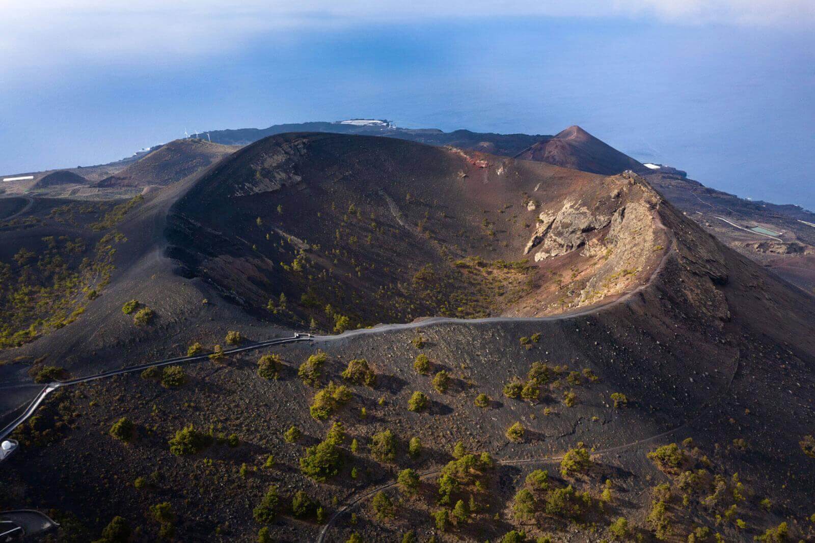
The Volcano Route, a trail among the giants of La Palma
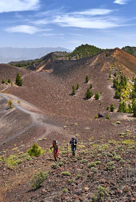
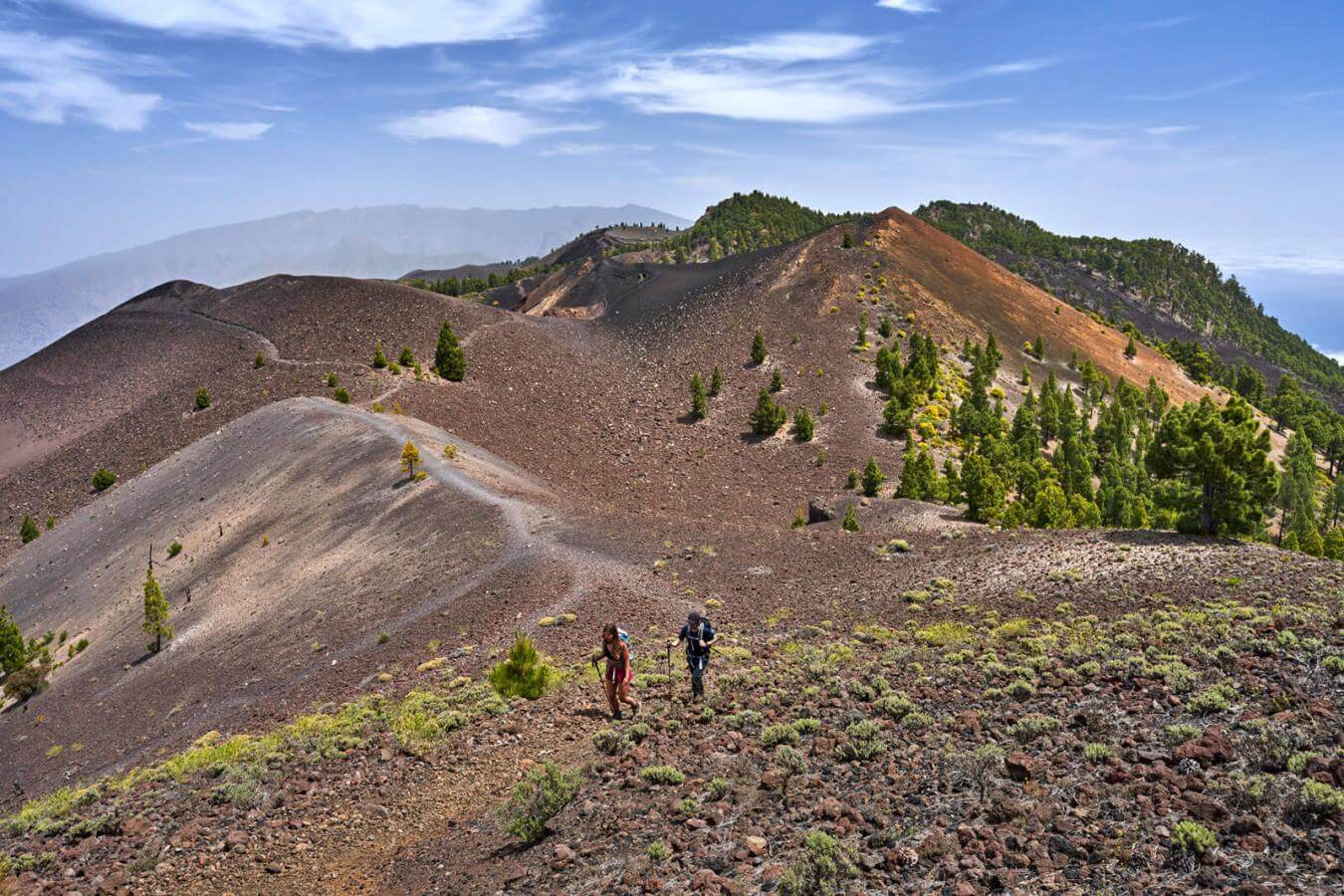
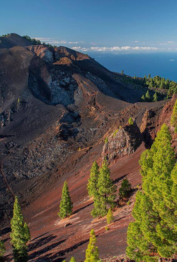
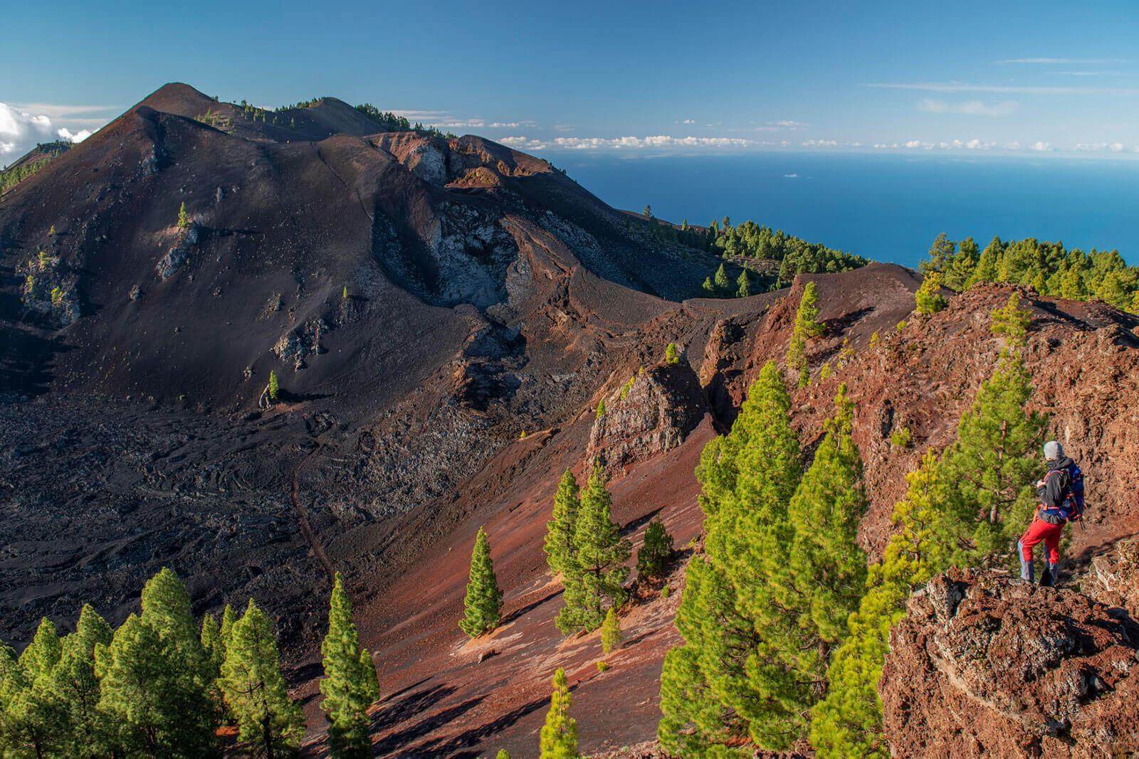
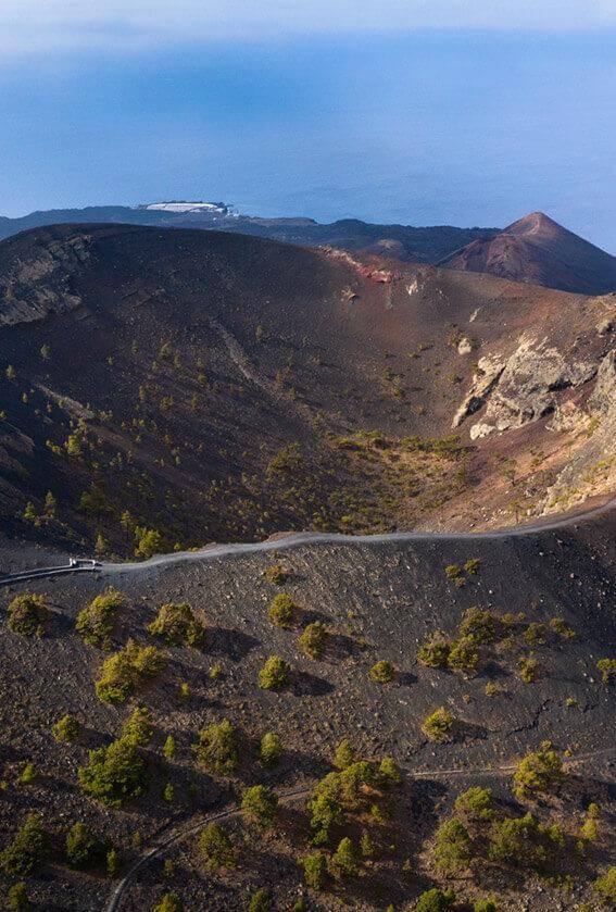
La Palma is famous for being a land of volcanoes. Its geography enables one to explore this phenomenon of nature from close quarters without running any risks. Most of them are in Cumbre Vieja, a large volcanic ridge located in the south of the island and characterised as the most active and best-conserved in the Canarian archipelago. It is also the start of the famous Volcano Route, a longitudinal trail that invites us to stroll among these giants that emerged from the interior of the Earth.

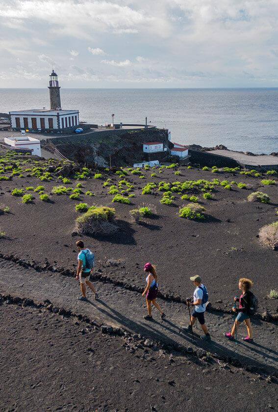
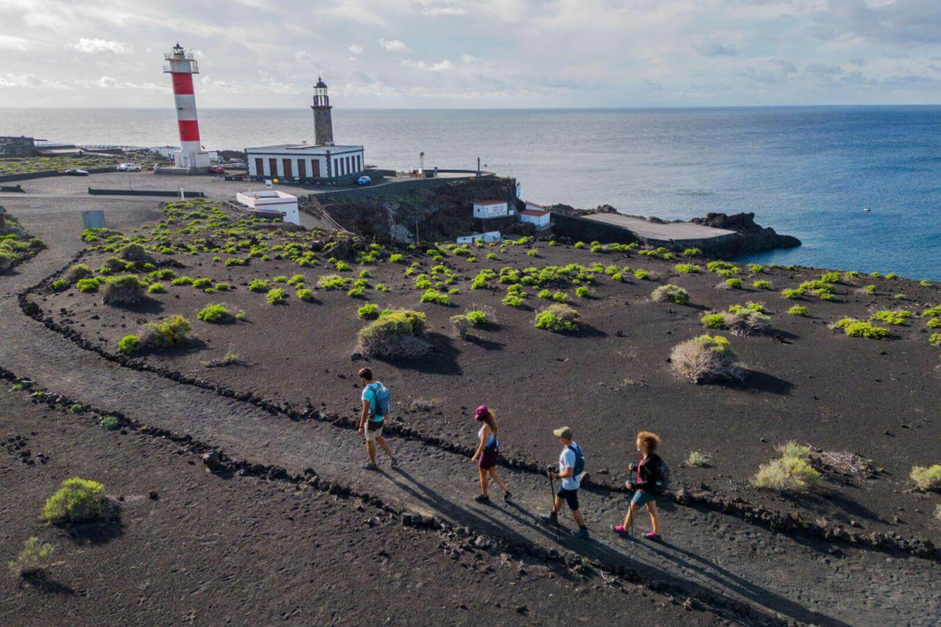
This path starts at Refugio de El Pilar, and leads us to Fuencaliente, where the Teneguía volcano is, the eruption of which in 1971 was the last one to take place in La Palma until the 2021 eruption. From this volcano, all that remains is to follow the path until descending and finding the saltworks and the lighthouse of Fuencaliente, the southernmost point of the island and the end of the route.
From Refugio del Pilar, located at an altitude of about 1,500 metres, the route runs along just over 18 kilometres on which we can discover craters, lava lakes and flows where vegetation grows. A little further on, and at a maximum altitude of 2,000 metres, we find Las Deseadas, and have the chance to stop and contemplate what are for many the best views of La Palma, from where, on clear days, it is possible to see Tenerife, La Gomera and El Hierro.
More historic volcanoes to visit
As well as Teneguía, where we can enter into the area that was most affected 50 years ago, there are other volcanoes where more discoveries can be made.
Some decades before Teneguía and Tagoro, in 1949, it was the volcano of San Juan on the island of La Palma (also known as Nambroque) that registered volcanic activity. Over time, vegetation has reclaimed the terrain, giving rise to a spectacular contrast of blacks and greens, as well as the possibility of enjoying it by taking a stroll through the old lava flows of the volcanoes.
Even older, and as a result probably less well-known, although equally fascinating, is the volcano of San Antonio. It is located in Los Canarios, at the end of the Volcano Route, and its eruption dates back to 1677-1678. This volcano is very accessible for all types of walkers, as the trail is fully adapted for people with reduced mobility. Its crater, which forms a near-perfect circle, is an excellent place from which to contemplate Teneguía in all its splendour.
Our thanks to Dr. Juana Vegas Salamanca, Coordinator of the Heritage and Geodiversity Research Team at the Geological and Mining Institute of Spain (Spanish National Research Council) for her collaboration on the creation of this article.