


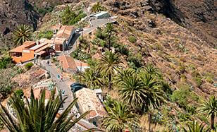
Traditional houses on the edge of a ravine in Teno
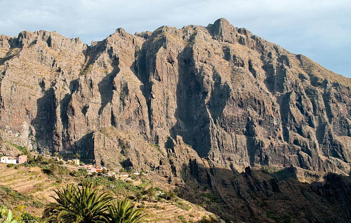
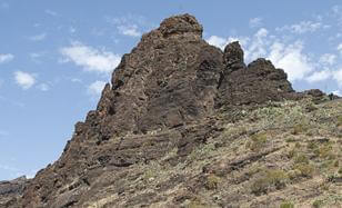
Masca is, without doubt, the best-known and most visited village in Teno Rural Park. Its few houses are home to about 100 people and stand in a V shape around a deep ravine in the peaks of Teno, in the west of Tenerife. The huge cliffs with dramatic angles that circle the area make the visitor feel they are light years away from the rat race and from everyday worries.
The architecture of the houses in Masca houses is simple and charming, with gable tiled roofs, thick basalt and mortar walls, and strong wooden doors. It’s definitely worth visiting the small 18th Century chapel in La Piedra and the restaurants serving typical Canarian dishes. The hamlet is also the starting point for a trek down the ravine, starting at 726 metres altitude and winding 4.5 kilometres down to the sea.
Shortly after you have left the town, you will cross the gorge for the first time on a wooden bridge. From here on, the trail will take you from one side of the gorge to the other and depending on the time of the year and rainfall, the gorge might be filled with water. The rocks in the gorge are round and smooth because of the constant erosion, so be careful while crossing them.
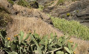
These plots are the last signs of human intervention in this area, before you enter the more deeply-set parts of the ravine where there is no place for cultivation. These plots were used for subsistence farming. In fact, the town has been set up in the ridge that is least suitable for cultivation, thereby saving the slopes for terraced plots.
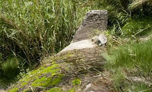
This small dam collects water from the La Vica area, the Madre del Agua ravine and the Masca ravine that you are hiking down. To the left of the gorge, you can see a canal that used to direct water towards the small cultivation plots in the lower part of the ravine.
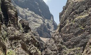
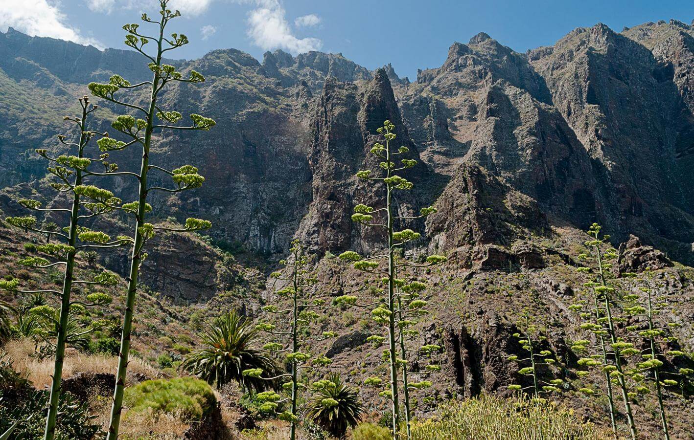
After the dam, you are now in the most closed-in and narrow section of the ravine. There is a greater danger of landslides as this area is boxed in between walls that are many hundred metres high. The trail gets more complicated as you have to cross over from one side of the gorge to the other. If you look up, you can see that the rocky walls have been eroded and randomly shaped by the run-off in the gorge. You can let your imagination run wild as you look at the different shapes of the rock.
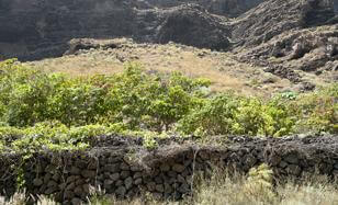
A relatively gradual slope was converted into a small, terraced cultivation area, which was irrigated with water from the ravine. The amount of effort invested in adapting this area to cultivation is truly impressive. If you look back, you can see a spectacular opening in the rock, which shows how the erosive processes in the ravine keep changing.
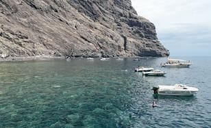
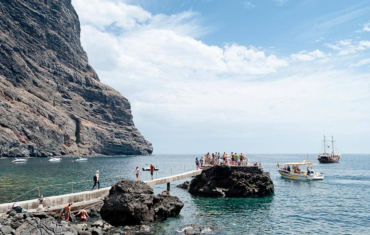
Masca beach is the typical beach found at the mouth of a ravine, where most of the coastline is divided into coves, though there are also sandy banks, depending on the tide and the weather. On either side, you have the imposing Los Gigantes cliffs towering at 400 metres that protect this idyllic cove where you can rest and take a swim after completing the descent.
- Never leave waste of any type lying around, including cigarette butts. Leftover food leads to a proliferation of rats and wild cats, which pose a serious threat to the fauna.
- Respect the animals. Do not bother them or feed them. If you see an injured specimen, you can call the emergency number: 112. Do not pick flowers or plants.
- Do not pick up or take away stones or any other item from the natural environment. And do not move them to pile them up into sadly famous 'towers'.
- Respect the signposting along trails. Leaving the set paths causes damage to the environment and could also be dangerous for you and anyone with you.
- It is safer to keep your pet on a lead.
- Try not to alter the peace of the environment with excessive noise (loud music, yelling, etc.).