
There are two sides to the south of El Hierro. One is made up of a huge scale of greens, and the other is a whole ocean of hues of blue. A municipality of 84.95 square kilometres full of contrasts and a wealth of nature so singular it needs to be observed from land, sea and air.

An ode to outdoor enjoyment
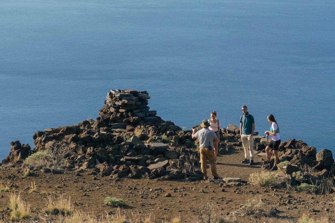
Pleasant temperatures throughout the year and a catalogue of landscapes that leaves absolutely nothing to be desired; El Pinar has everything you need to enjoy nature in all its splendour. Eighty percent of its territory is protected, as it is home to the lush pine forests that give the municipality its name, volcanic landscapes that stretch across the island to the south - showing signs of recent eruptions - cliffs, rugged mountainsides, steep slopes, mega-landslides such as those that can be seen in the area of El Julan and a spectacular coastline with coves and pools. In addition to all this, El Pinar is where the highest point on the island, Pico de Malpaso, is located, and as a result of this and the island’s relief, the El Pinar area is sheltered from the trade winds, playing a key factor in the tranquil waters of the Mar de Las Calmas.
The gateway to the Mar de Las Calmas
As if the many landscapes throughout the municipality were not enough, a natural treasure in the form of a marine reserve lies beneath the coast of El Pinar. It was created at the request of the island’s fishermen, to protect their waters. The rugged volcanic seabed here is home to a huge number of marine species, some of which are native to the archipelago like the bocinegro (common seabream) and others that are simply passing through as part of their migratory cycle, like the unexpected but inoffensive whale sharks. This unique combination, together with the archipelago’s climate conditions and the clarity of the waters, has made El Hierro one of the best diving destinations in the world.
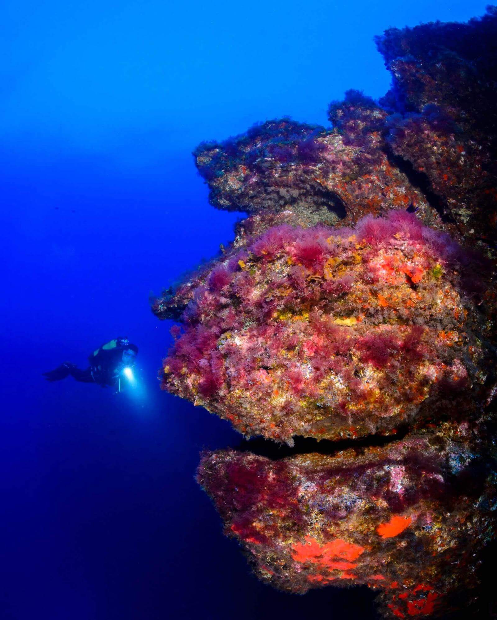
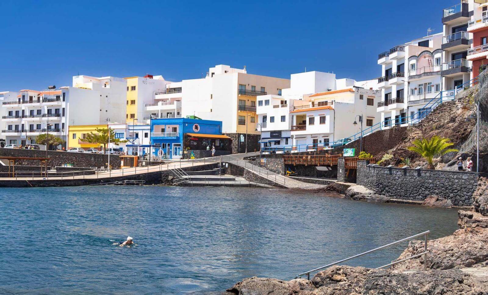
One of the most idyllic spots where one can enjoy a dip is Tacorón, a little oasis of peace located in the south-west of the island, known for its natural swimming pools, which are perfect for quenching the thirst for exploration of snorkelling and diving enthusiasts. However, to get to know the Mar de Las Calmas in more depth, the most popular destination is La Restinga, a small fishing village that exudes tradition from every single nook and cranny. Although it has fewer than 600 inhabitants, the harbour here is a hive of activity. It supplies the local restaurants, famous for the freshness and quality of their fish, on a daily basis, but also provides a range of leisure activities such as scuba diving, whale watching and different board sports.


The secret language of the Bimbaches
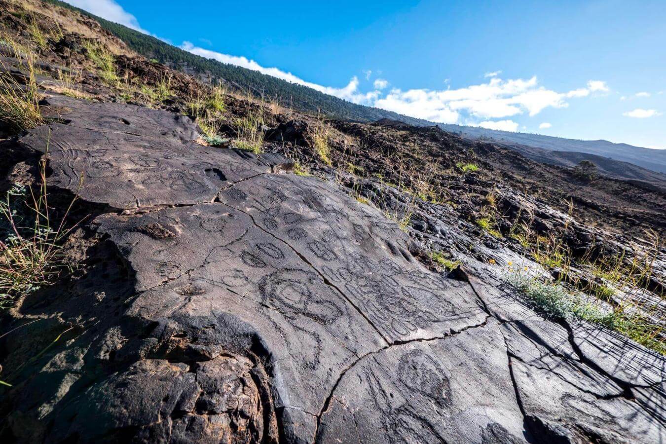
The history of the Canary Islands dates back to before the Spanish conquest, when they were inhabited for centuries by the indigenous people of ancient times. El Hierro was home to the Bimbaches, a society with a strong agricultural, pastoral and fishing identity, a legacy whose mark still remains latent both in the concheros (archaeological sites with an accumulation of mollusc shells) they left behind and in the local population, their culture and their beliefs. One good example of this are the herreño cheeses and the pottery, which is still produced today in a completely traditional way without using a potter’s wheel, just as the ancestors did.
However, the legacy of the Bimbaches does not end here. Throughout the island one can find petroglyphs carved into the rocks, which have not yet been fully deciphered. And one place they positively abound in is west of El Pinar, in El Julan Cultural Park. This area, which once served as a meeting place for the first inhabitants of El Hierro, now houses an interpretation centre open to the public and an archaeological site where you can book in advance to learn more about these ancient inscriptions with the help of a local guide.

Places steeped in history
As well as following in the footsteps of the Bimbaches, El Pinar also offers a window onto other historical periods and moments. The Geopark Interpretation Centre, for example, enables one to go back to 2011 and experience first-hand the eruption of the Tagoro underwater volcano or travel millions of years back in time to learn how different volcanic eruptions shaped the terrain of the entire Canary Islands archipelago.
The municipality is also home to the Geological Interpretation Centre, a former social club converted into a space for learning that focuses on the geological, ethnographic and cultural treasures of the island, the same values that led to it being declared a UNESCO Global Geopark. Inside, you can discover interesting facts such as why El Hierro has such a peculiar shape, the different types of rock that can be found on the island, and how the locals are able to transform them into craft objects.
At the other end of the municipality, right on the coast, is Punta de Orchilla, a place that quite simply exudes magic. For centuries, many sailors considered it the end of the world and later, in the 17th century, it was designated as the Zero Meridian. Today, despite no longer holding these titles, it still offers one of the most beautiful sunsets in the Canary Islands and has become a valuable natural observatory from which to gaze at the starry night sky.