

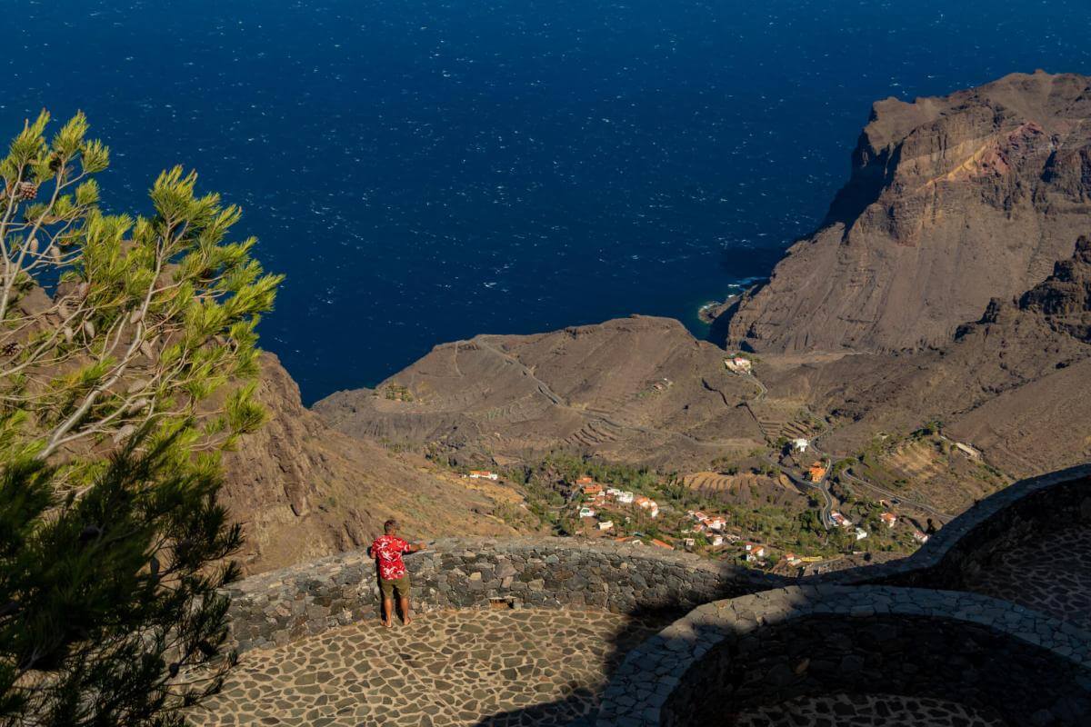


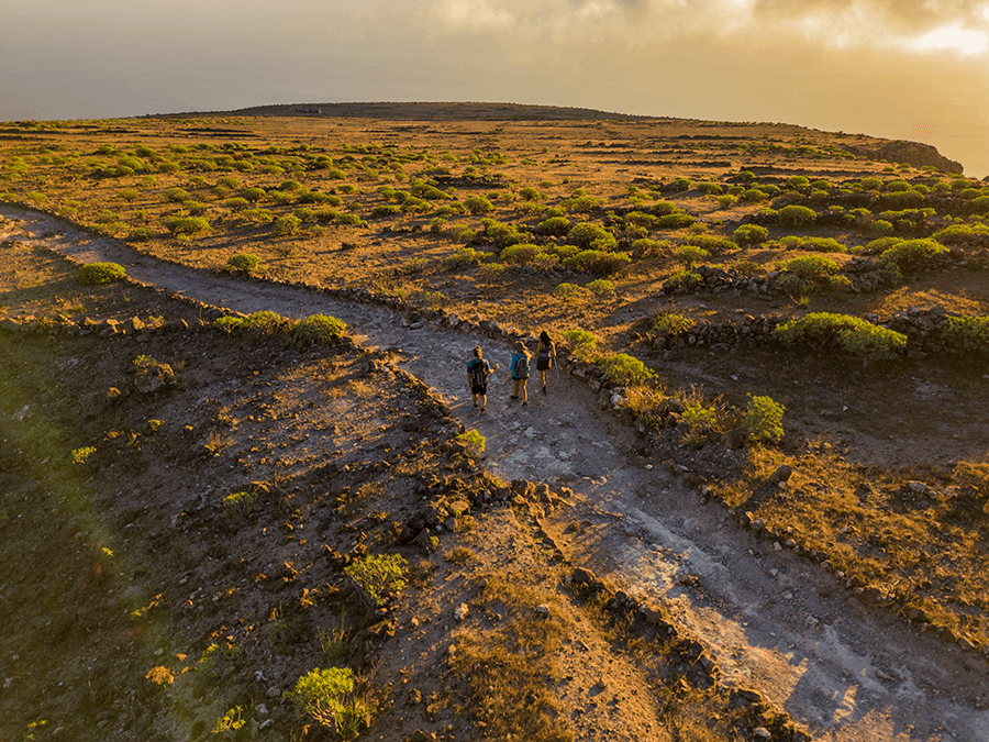
Distance from Point A to Point B: First stage / Mirador El Santo – Risco de La Mérica, 4.5 km
The route begins at the Mirador El Santo in Arure, with spectacular views over the valley and the Atlantic. From here, the descent starts along an old cobbled path that crosses mountains, ravines and corners full of history.
Along the way, highlights include the El Santo aqueduct, the panoramic Mirador de La Mérica, the volcanic landscapes of El Verodal and old lime kilns that recall the island’s traditional practices. Near the end, the Cueva de Tejerigüete offers a glimpse into La Gomera’s pastoral past.
The stage ends at the Risco de La Mérica, a natural viewpoint perfect for enjoying the grandeur of the Gomero landscape.
Distance from Point B to Point C: Second stage / Risco de La Mérica – La Calera, 2.6 km
Risco de La Mérica is one of the most impressive natural balconies in the southwest of La Gomera. From the top, a spectacular view opens over Valle Gran Rey, its ravines, agricultural terraces and the Atlantic coast.
This enclave stands out for both its natural and cultural value. It is a refuge for the La Gomera Giant Lizard, one of the island’s most unique species, and preserves traces of the past such as old paths and areas where the prized orchilla — the “purple gold” of La Gomera — was once collected.
The cliff is also an ideal place to enjoy silence, photography and birdwatching. Its connection with the Silbo Gomero, which used to echo between these slopes and ravines, adds a unique cultural dimension to the route.
From this point, the descent begins toward La Calera, with landscapes that gradually draw closer to the sea.
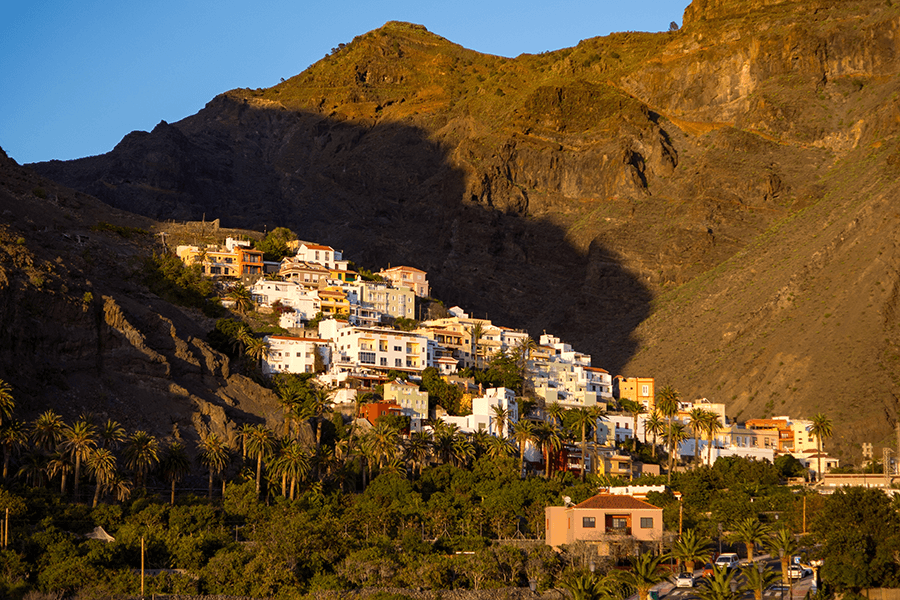
Distance from Point C to Point D: Third stage / La Calera – Playa del Inglés, 1.8 km
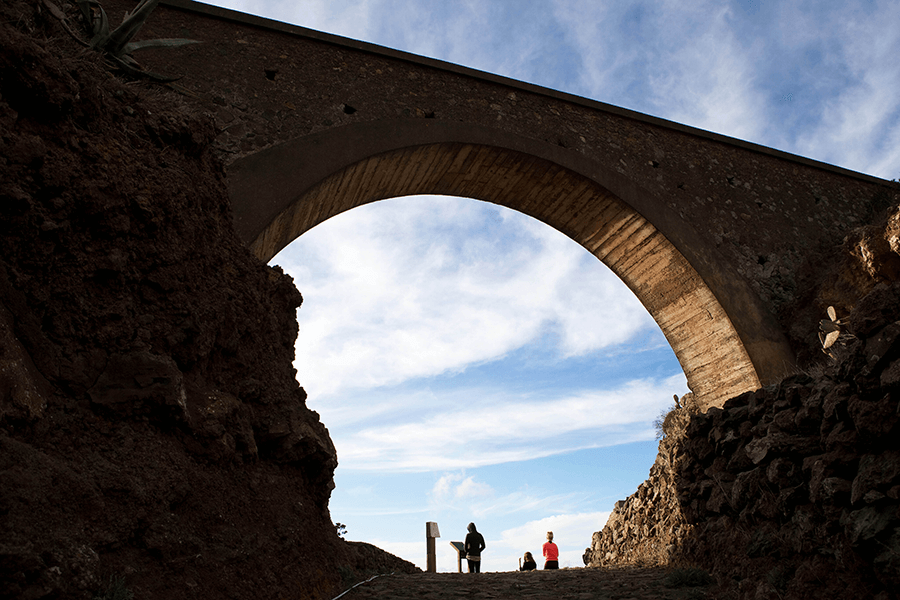
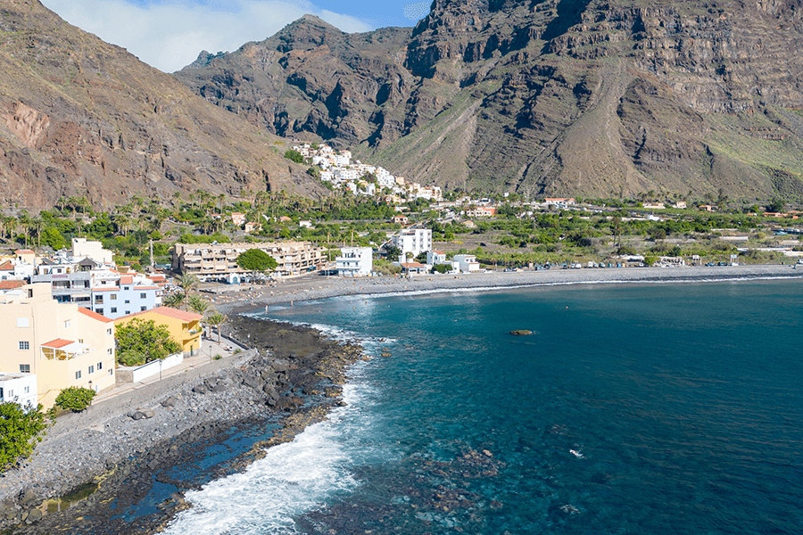
After descending the Risco de La Mérica, the path reaches La Calera, a historic neighbourhood of Valle Gran Rey known for its white houses perched above the valley and its sea views. Its narrow, cobbled streets invite visitors to wander slowly, discovering traditional architecture, old terraced crops and small bars where local products can be enjoyed.
The area preserves its rural essence and offers natural viewpoints with unique panoramas. Nearby stands the La Alameda Museum, ideal for learning about the history of the valley, and on Sundays the neighbourhood hosts a craft and gastronomy market.
From here, the route continues toward the coast to visit Playa del Inglés, just a short walk away, before following the trail along the Atlantic.
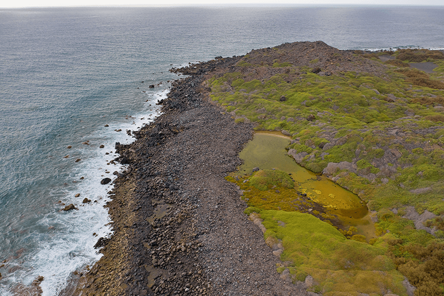
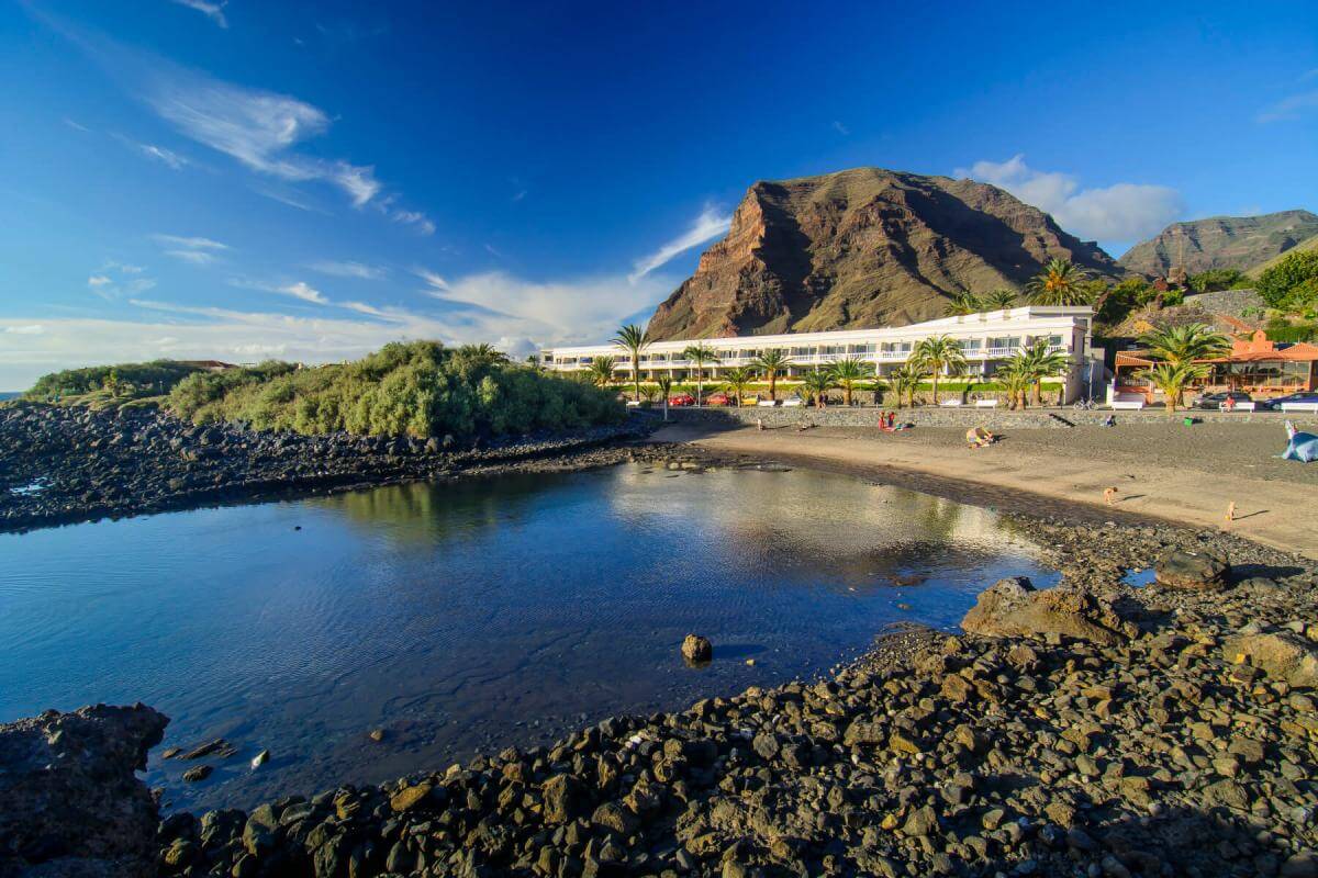
Distance from Point D to Point E: Fifth stage / Playa del Inglés – Playa de La Calera, 1.1 km (3 minutes on foot)
Playa del Inglés is one of the most authentic corners of the southwest of La Gomera. It is wrapped in an old legend about a shipwrecked English sailor, which gives the place a touch of mystery. With its cliffs, volcanic sand and virtually untouched landscape, it is the perfect spot to disconnect and feel nature in its purest form.
Very close by lies the Charco del Cieno, a protected wetland and one of the last natural salt marshes in the Canary Islands. It is a key habitat for birds and specialised flora, ideal for ecotourism but extremely fragile. For this reason, it is recommended to observe it from a distance and enjoy it without disturbing its natural balance.
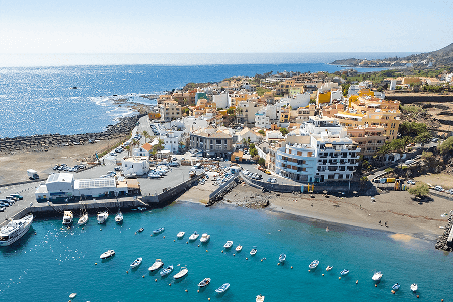
The route concludes at Playa de Vueltas, a coastal spot with a true seafaring soul and one of the traditional fishing ports still preserved in the Canary Islands. Its calm atmosphere, sheltered by cliffs, and the presence of birds such as herons, terns and turnstones make it an ideal place to rest and enjoy nature.
The neighbourhood of Vueltas, next to the beach, retains its historic character with old warehouses and fishermen’s houses. From here, boat excursions depart to watch dolphins and whales, and to visit unique coastal sites such as Los Órganos. It is also a great starting point for activities like kayaking, snorkelling or diving.
A perfect end to the route: sea, tradition, local life and an authentic atmosphere that captures the essence of Valle Gran Rey.
Distance from Point E to Point F: Sixth stage / Playa de La Calera – Playa de Vueltas, 1.7 km
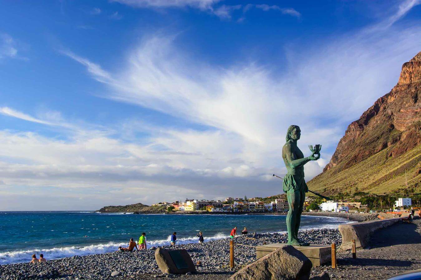
The coastal area of Valle Gran Rey brings together neighbourhoods such as La Playa, Borbalán, La Puntilla and Vueltas, today the touristic heart of the valley. In the past, it was an important agricultural and fishing enclave where tomatoes, bananas and tropical fruits were cultivated, and the pier handled boats loaded with goods.
Today, this coastal strip combines family-run accommodation, good gastronomy and a relaxed seaside atmosphere. In La Puntilla, the statue of Hautacuperche stands out — a symbol of Indigenous resistance — and nearby lies Charco del Conde, a natural pool ideal for families thanks to its calm waters.
The route ends at Playa de Vueltas, a small traditional port that preserves its seafaring spirit and closes the journey with an authentic atmosphere facing the Atlantic.
- Never leave waste of any type lying around, including cigarette butts. Leftover food leads to a proliferation of rats and wild cats, which pose a serious threat to the fauna.
- Respect the animals. Do not bother them or feed them. If you see an injured specimen, you can call the emergency number: 112. Do not pick flowers or plants.
- Do not pick up or take away stones or any other item from the natural environment. And do not move them to pile them up into sadly famous 'towers'.
- Respect the signposting along trails. Leaving the set paths causes damage to the environment and could also be dangerous for you and anyone with you.
- It is safer to keep your pet on a lead.
- Try not to alter the peace of the environment with excessive noise (loud music, yelling, etc.).