


The route begins at the Mirador de Alajeró, located in the upper part of the town’s historic centre. Below the viewpoint lies the Alajeró fountain, and across the street, the resting place of the Virgen del Paso. From here, the route heads north along the streets Castilla and Vega Vieja, leaving the town and passing by the Cheese and Pastoralism Interpretation Centre, which hosts an interesting exhibition on this ancestral tradition.
Distance from Point B to Point C: Second stage / Ermita de San Lorenzo, 2.1 km
The Virgin who guards the pass
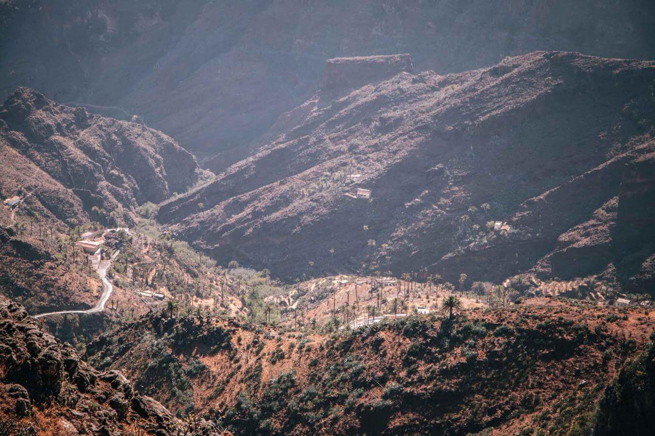
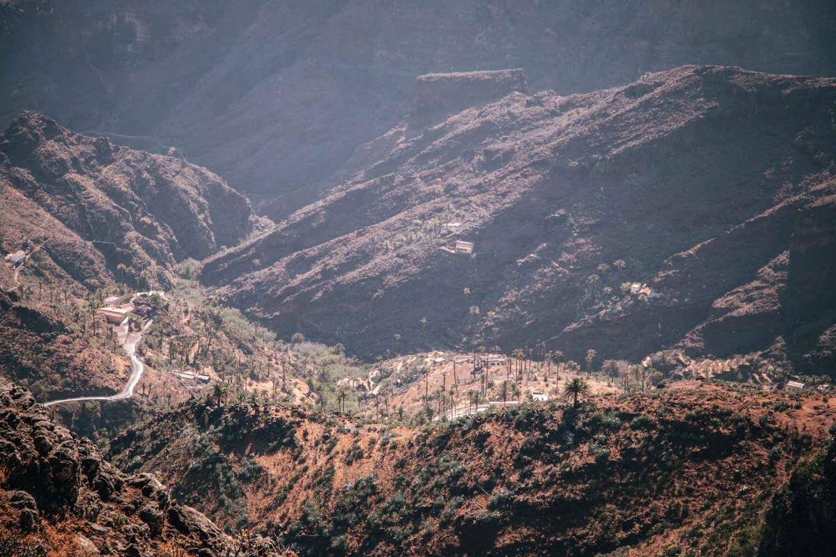
The route follows paths along the edge of the Barranco de Los Charcos, an area protected as a Special Area of Conservation within the Natura 2000 network, until it reaches the Ermita de Nuestra Señora del Buen Paso. Its location is no coincidence: positioned at the head of the basin, it occupies a traditional passageway toward the central plateau — historically a place where local communities accessed natural resources essential to life in this southern region of La Gomera.

Distance from Point C to Point D: Third stage / Hamlet of Arguayoda, 3.9 km
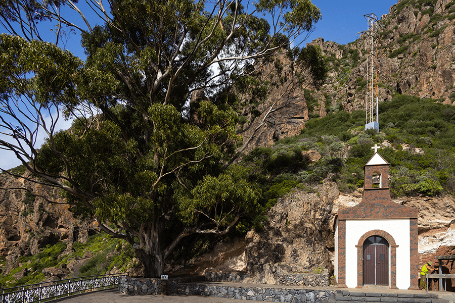
The Ermita de San Lorenzo, built around 1502, is one of the oldest chapels in La Gomera and stands out for its isolated location, far from any inhabited settlement. It is believed that this place already held spiritual importance for the ancient Gomeros, which would explain its alignment with the winter solstice and with sacred sites such as the Fortaleza de Chipude and Montaña de Tagaragunche. Today, the hermitage is a privileged viewpoint with spectacular views over the Barranco de Erque and the fortress itself — a perfect spot to connect landscape, history and spirituality.
Distance from Point D to Point E: Fourth stage / Barranco de La Negra, 4.7 km
Arguayoda, the great hillside of Alajeró
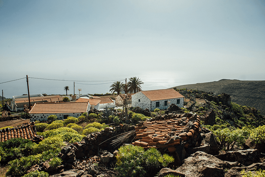
We find ourselves on the hillside of Arguayoda, the most impressive in Alajeró: eleven linear kilometres of terraces stretching between the ravines of Erque and La Negra, dotted with the hamlets of La Manteca, El Drago and the one that gives the area its name — Arguayoda. This long band of terraced land is one of the clearest examples of the struggle of Gomero society to carve out cultivable soil. A landscape of stone walls and narrow farming platforms created to tame the rugged island relief and grow the cereals that once sustained local life.
Distance from Point E to Point F: Fifth stage / Barranco de Los Charcos, 2 km
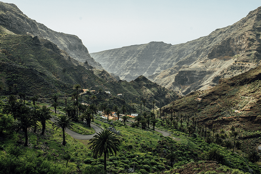
Barranco de La Negra is a small oasis amid arid hills, where the path runs close to old houses and a hidden palm grove along the ravine bed. This enclave, possibly linked to ancient Indigenous worship and aligned with sacred places such as the Fortaleza de Chipude, offers spectacular views of the volcanic landscape and the Barranco de Erque. The route continues along a stone-paved trail lined with palm trees and natural pools, where the balo stands out — a Canary Islands endemic that forms a small grove at the bottom of the ravine. A surprising corner that combines nature, mystery and an exceptional landscape.
Distance from Point F to Point G: Sixth stage / Iglesia del Salvador, Alajeró: 2.6 km
Barranco de Los Charcos, a landscape shaped by herding
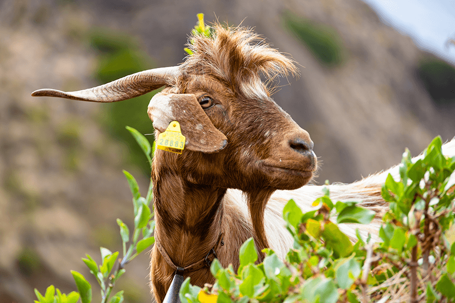
Before returning to Alajeró, the route crosses the Barranco de Los Charcos once again. Just above the point where we first crossed it, there are still remnants of thermophile woodland, although this lower section is more altered. This area reveals the strong herding vocation of the territory: along the way we encounter goat farms, and it is easy to observe how the old terraces have become grazing lands, replacing the crops that once occupied them.
Distance from Point G to Point H: Sixth stage / Foot of Montaña de Tagaragunche, 1.1 km
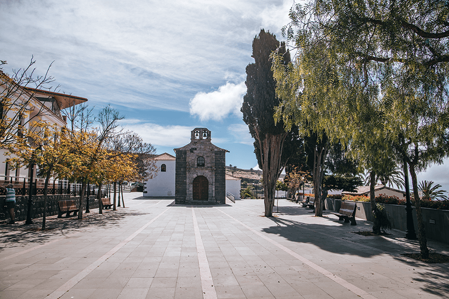
The route climbs from the ravine up to the Plaza de Alajeró, dominated by the Iglesia de El Salvador, whose foundation dates back to the mid-16th century, possibly before 1550. This church stands out for its late-Renaissance stone façade from the 18th century. It consists of a single nave with a chapel attached on the Gospel side.
Distance from Point H to Point I: Sixth stage / Summit of Montaña de Tagaragunche, 0.3 km
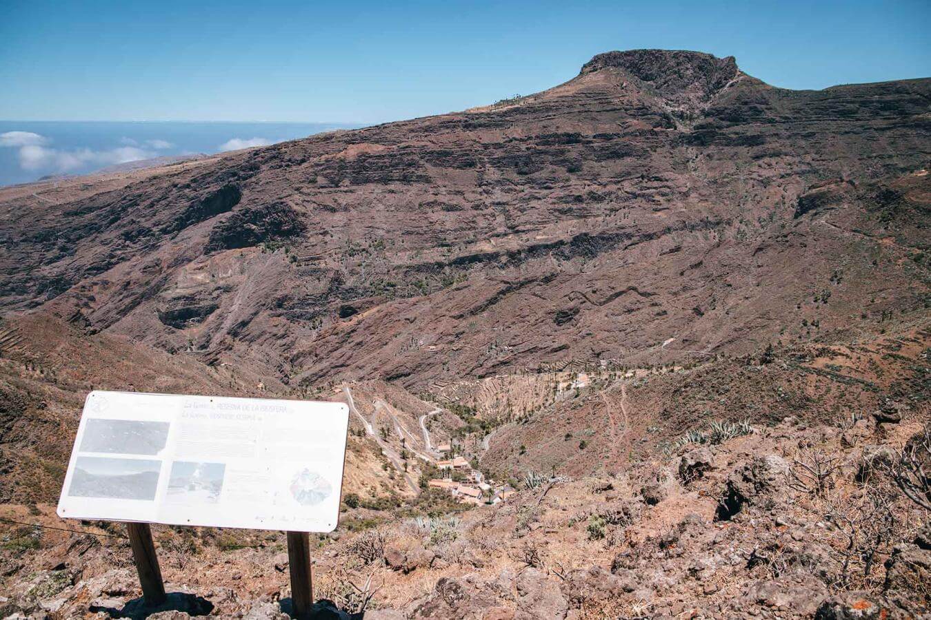
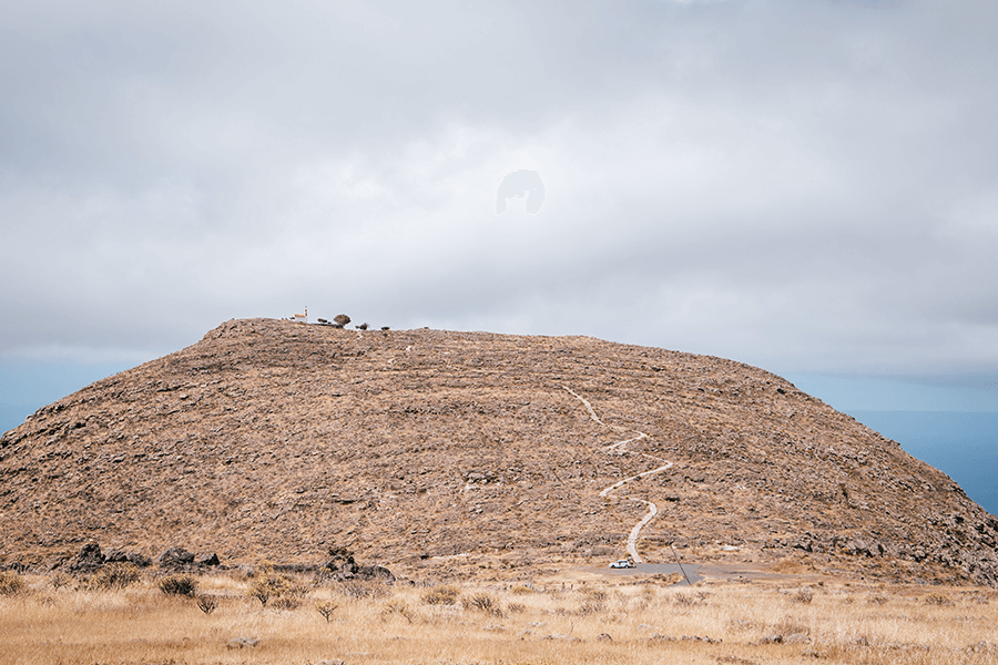
The syenite rock of Alajeró
The route leads us, leaving the settlement of Alajeró — where we began — on our left, toward Montaña de Tagaragunche. The site has significant geological value, as it forms part of the syenitic rock complexes belonging to what is known in the island’s geological history as the Recent Edifice II: lava flows that filled earlier valleys on the island. Its estimated age is around 4.3 million years.
Syenitic rocks are perhaps the most distinctive geological feature of La Gomera; they correspond to trachytes and phonolites. Montaña de Tagaragunche belongs to the so-called recent syenitic formations, along with La Caldera — located on the Alajeró coast — and the Fortaleza de Chipude. The mountain’s significance is reinforced by its symbolic meaning. We may refer to it as the “Mountain of the Three Names”: the original Indigenous name, Tagaragunche, and the later Christian ones, Calvario and San Isidro.
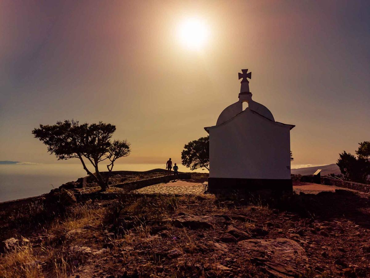
End of the route – Montaña de Tagaragunche
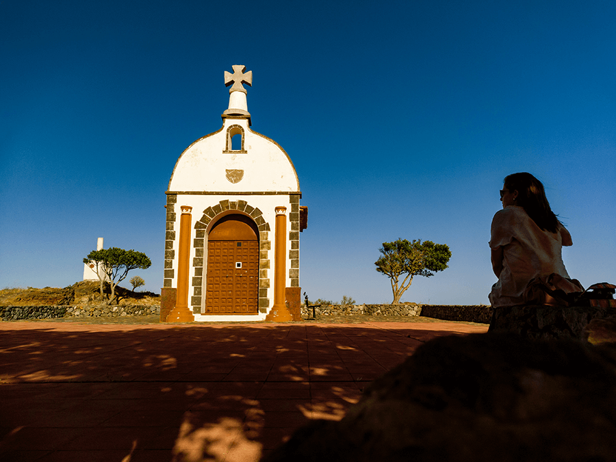
A summit that honours agriculture
Tagaragunche is now known as the Mountain of San Isidro, named after the small chapel located at its summit — a clear example of syncretism, where the new religion overlays the original one. On 15 May, a mass is held in honour of the saint, followed by a procession accompanied by chácaras and drums, part of the island’s folk heritage and a reminder of its Indigenous past. From the top, the views reveal the landscape of Alajeró with its characteristic rolling hills, crossed by countless terraced fields.
- Never leave waste of any type lying around, including cigarette butts. Leftover food leads to a proliferation of rats and wild cats, which pose a serious threat to the fauna.
- Respect the animals. Do not bother them or feed them. If you see an injured specimen, you can call the emergency number: 112. Do not pick flowers or plants.
- Do not pick up or take away stones or any other item from the natural environment. And do not move them to pile them up into sadly famous 'towers'.
- Respect the signposting along trails. Leaving the set paths causes damage to the environment and could also be dangerous for you and anyone with you.
- It is safer to keep your pet on a lead.
- Try not to alter the peace of the environment with excessive noise (loud music, yelling, etc.).