


Degollada de Cruz Grande is the natural link between the Tirajana basin and those of the eastern part, the ravines at Chira and Soria. We will go up along a track which leaves the road a short way before getting to the mountain pass if coming from Las Tirajanas, to come across a Calvary from where the path heads towards a hill which has fabulous views of the basin of Tirajana and the ravines of Chira and Soria with their great dams.
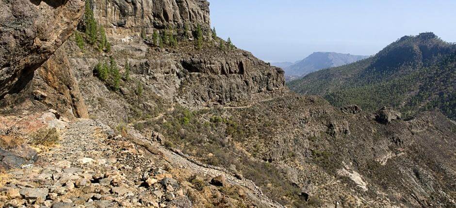
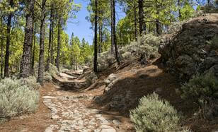
This stretch of cobbled path of less than a kilometre dates from the end of the XIX century. The aim of its construction was to facilitate the movement of livestock along the summit, thus avoiding a longer route to the cirque at Ayacata. This pass overcomes the complicated gorge between the southern cliffs of the summit with cobbles that stand the test of time.
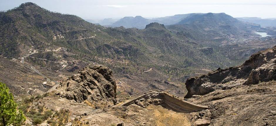
This small dam is another example of the importance of water at the peaks of Gran Canaria. On the same slope, these small dams take advantage of the runoff on the bare high flatlands to store the water which would otherwise meander through the cliffs.
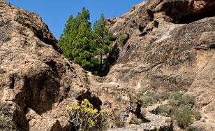
This is an area bare due to erosion, which explains the existence of the hanging dams on the lower slope. This rocky mound also known as Cortijo de Pargana is where we see the morphology of La Agujereada which is a volcanic combination of holes and natural caves which appear on the edges of this rocky flatland where the pathway appears like a light to lead the way.
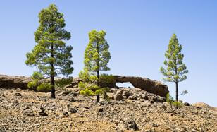
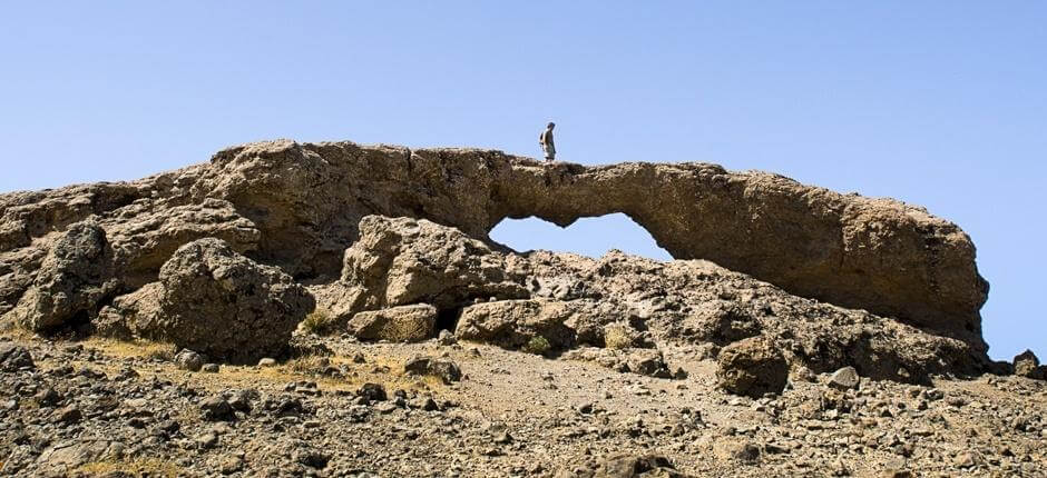
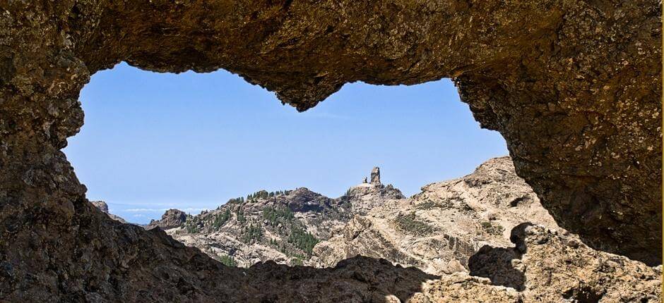
These stone bridges appear throughout the island’s geography as a result of the effect of differential erosion and they are known as agujeros (holes) or agujereados (holed). This is called Agujereada de la Fuentecilla although its framed picture of Roque Nublo has made it better known as “the window to the Nublo”.
The pathway coming from the slopes of the Tirajana ravine rises to this mountain pass, whose name reminds us of the traditional forest work in which one of the materials used was pine tar. This was obtained from burning pine trunks in tar pits from where the tar was distilled and then used as waterproofing. In the Canary Islands pine tar is called Pez. The slopes of this col were ideal for these tar pits as they had to be built on a 30% slope to make distilling easier,
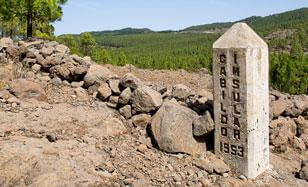
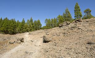
These flatlands were completely bare by the middle of the XX century; its pine trees were felled to produce pine tar. This is where the place gets its name from, the reforestation policies of the Gran Canaria local government have returned the pine forests to this flatland, as we see with the boundary markers on the edge of the pathway which mark the public property and which date from that era. Mixed in with the pine forest are apple trees planted as an experiment.
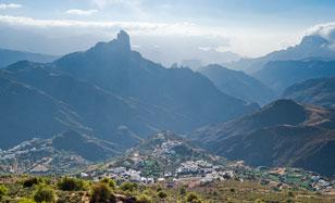
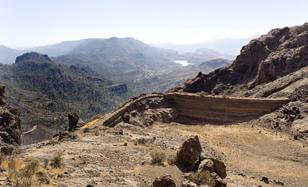
This viewpoint allows us to enjoy the splendid view of the head of Tejeda ravine with Roque Bentagya as the landscape’s central landmark, one of the main enclaves of the ancient Canarians in this basin with important archaeological remains. The view offers us a perspective of Roque Nublo, as well as the villages of the basin, the main one being Tejeda, but also others like Cuevas Caídas or La Culata under the viewpoint. Next to the viewpoint is the Gran Canaria Biosphere Reserve visitors’ centre.
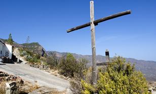
The purpose of the Tejeda Cross was to guide walkers along the Gran Canaria summit from the XVII century, as a great number of routes converge in this spot and in fact in the past it was known as mountain pass of the Cross. Besides it is located practically in the geographical centre of the island; the present day cross of green stone dates from the 1970s, having replaced a previous one from the 1960s which was destroyed in a storm. The Tejeda Cross is located in a place where the trade winds blow hard.
- Never leave waste of any type lying around, including cigarette butts. Leftover food leads to a proliferation of rats and wild cats, which pose a serious threat to the fauna.
- Respect the animals. Do not bother them or feed them. If you see an injured specimen, you can call the emergency number: 112. Do not pick flowers or plants.
- Do not pick up or take away stones or any other item from the natural environment. And do not move them to pile them up into sadly famous 'towers'.
- Respect the signposting along trails. Leaving the set paths causes damage to the environment and could also be dangerous for you and anyone with you.
- It is safer to keep your pet on a lead.
- Try not to alter the peace of the environment with excessive noise (loud music, yelling, etc.).