
Whether above the clouds or at sea level, the Canary Islands can also be explored on foot.
There are trails that are famous like Machado, about which the Spanish singer Joan Manuel Serrat sings about. There are other trails that attract pilgrims from all over the world, such as the Camino de Santiago. There are also historical trails, such as the Camí de Cavalls, in Menorca, which dates back to 1330. There are some trails for professionals, others for beginners; there are those by the sea or in the mountains. In the Canary Islands there are trails for everyone: historical, for the family or for the more adventurous, which take you to a beach or to a mountain top. We explore the islands of eternal spring through their trails.
Lobos Islet (Fuerteventura)
A colony of sea lions lived here until a few years ago. (hence the name of the islet). Since 1865 there has been a stable human settlement. But now, and in order to preserve it, a permit is needed to visit the islet, which must be requested no more than three days in advance and which allows the visitor to stay on the island for four hours, either in the morning or in the afternoon. It’s enough time to hike the route along its trails and visit the salt mines of Marrajo, the lighthouse of Punta Martiño, as well as the Puertito, a small fishing village that is no longer inhabited. The route is simple, practically flat, with a drop of 22 meters, so despite being seven kilometres long, it can be done in two hours.
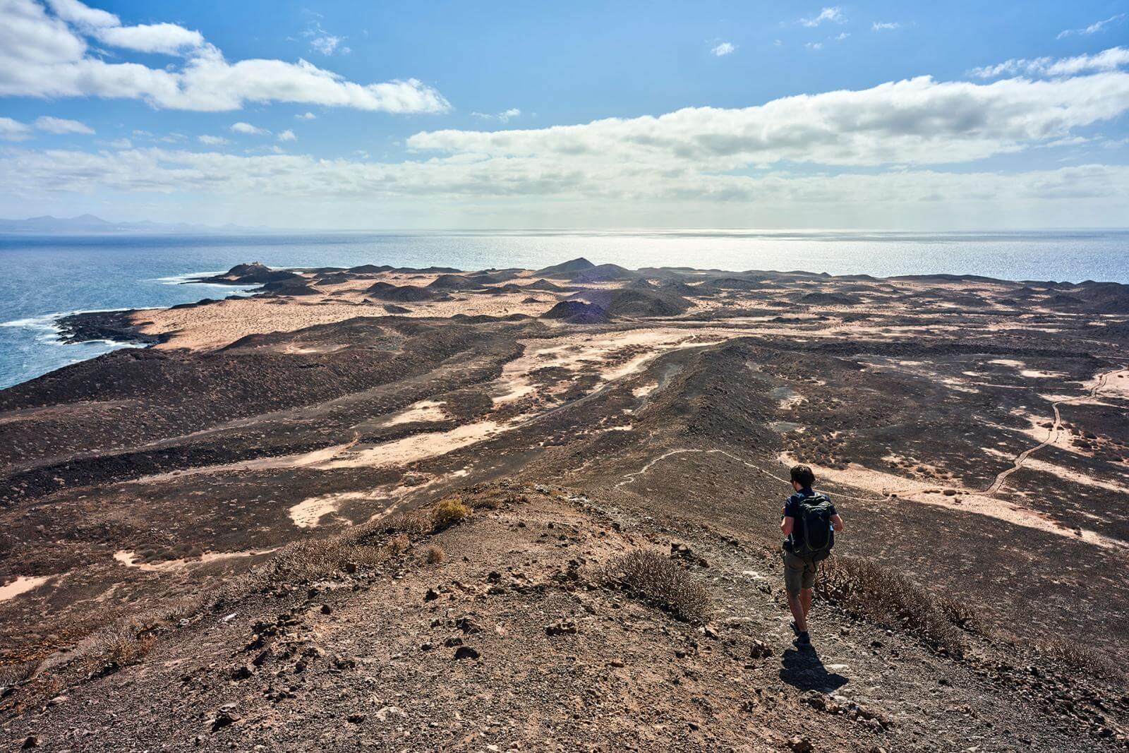

Duration: 2 hours (7 km).
Elevation: 22 meters.
Difficulty level: easy.
Los Gracioseros (Lanzarote)
This route lasting three hours, 90 minutes there and 90 minutes back, transports us to a spectacular landscape through the route walked every day by the inhabitants of the neighboring island of La Graciosa, to go and return from Lanzarote. It is 3.5 kilometres long, with a difference in level of 358 metres and medium to high difficulty, since the Riscos de Famara are not at all easy and the ground has loose gravel that makes it difficult to descend. At the beginning of the path, leaving from Yé on the way to Guinate, you can see the northern coastal area of Lanzarote and the strait that separates it from La Graciosa, known as El Rio. Once you start down the winding roads, you can see the endemic species, many of them protected. As a reward, it is mandatory to take a bath when you get to the beach, and then return.

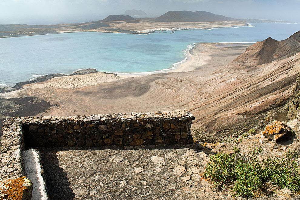
Duration: 3 hours (7 km).
Elevation: 358 meters.
Difficulty level: medium-high.
Silver Route (Gran Canaria)
Before roads existed, islanders used these paths to move from one place to another, as well as to move their herds and livestock in search of new pastures. With the passing of time, this road, which is more than a century old, was abandoned for these purposes and is now used only for trekking, hiking and pilgrimage. The route is well signposted thanks to this. During the journey we are accompanied by the fabulous Canarian pines, tajinastes and verodes. There are 13 kilometres of alternating paving, forest tracks and asphalt. The route can be done in less than five hours, with a height difference of 838 meters and a medium level of difficulty. The Roque Nublo stands out among the spectacular landscapes that we can observe during the route, an imposing volcanic monolith and one of the largest in the world, located in the heart of the island. The trail leads to the so-called “Cloud Window” at a high point, a rock formation with unforgettable views.

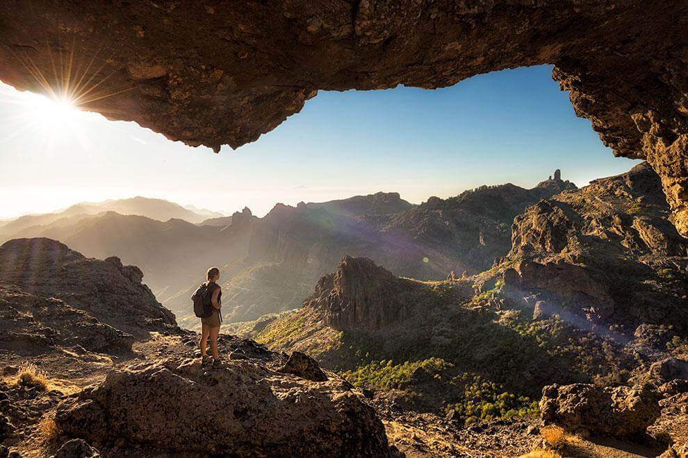
Duration: 5 hours (13 km).
Elevation: 838 meters.
Difficulty level: medium.
Climbing of Teide (Tenerife)
The highest mountain in Spain (3715 meters) and third highest volcano in the world is located in Tenerife. Teide, declared a World Heritage Site by UNESCO, is part of the National Park of the same name. The ascent to the top can be carried out on foot, through a marked trail, or by cable car. There are also several trails to explore the spectacular landscape around it, ideal with children and the whole family. The route to the base of the final peak takes six hours, with a maximum ascent of 1194 meters and a maximum descent of 812 meters. It is recommended only for people in good physical condition and without heart problems, because in addition to the difference in level, the high altitude must be taken into account. The Refugio de Altavista [Altavista Shelter], located almost at the top, allows you to stay for one night after applying for a permit and watch the sunrise from the highest point in the country. It is recommended to bring warm clothes for the evening. Both at sunset and at sunrise, you can see the shadow of the imposing volcano projected over the island and reaching the sea. This experience alone makes the journey worthwhile.

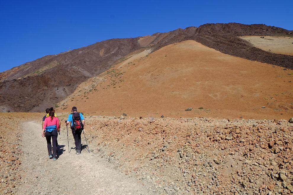
Duration: 6 hours (9 km).
Elevation: 1194 meters.
Difficulty level: high.
Caldera de Taburiente (La Palma)
Located in the center of the island, it is a circular crater of peaks, at almost 2500 meters of altitude. This area was declared a National Park in 1954 and is one of the main attractions of La Palma. The trails that can be walked in the Park run along the slopes of the impressive walls of the caldera, which are covered with Canary Island pines, as well as along the course of the ravines. It is necessary to wear suitable footwear, water and sun protection, as well as some kind of jacket, because at higher altitudes the temperature drops. The journey to the top of the Roque de los Muchachos, the highest point on the island at 2426 meters above sea level, takes approximately six and a half hours. It is also possible to arrive by car and take a shorter route to the foot of the peak of the Cross, travelling six kilometers. There are several companies that make the journey, either on foot or in vehicles. The reward for reaching the top is the spectacular views that, if the time of day is right, show the formation of clouds like a huge sea. When the clouds dissipate, you can see some of the other islands in the archipelago. If you go prepared, the Roque de los Muchachos is one of the best sites on the planet to see stars, which is why one of the best astrophysical observatories in the world is here.

Duration: 6.5 hours (11.5 km).
Elevation: 2426 meters.
Difficulty level: medium.
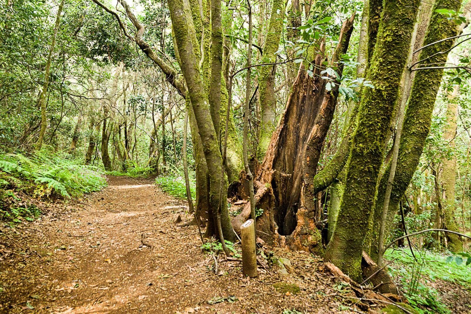
Contadero – El Cedro (La Gomera)
This route through Garajonay National Park, also a World Heritage Site, allows the hiker to imagine what forests were like millions of years ago. Different plant species such as vine, laurel and til take refuge in this humid laurel forest formation. There are about six kilometers and a height difference of 551 meters from Contadero to the El Cedro stream, which can be walked in three and a half hours through well-marked trails and forest tracks. Wrapped in an almost permanent fog, the humidity provided by the clouds, which the leaves of the trees are responsible for trapping, allows the survival of this forest that has already disappeared in most of the planet. You will reach a hermitage built in 1935 nearly at the end of the road. The relative difficulty of the route makes it advisable to wear suitable footwear, as well as long trousers. In the hamlet of El Cedro there is a campsite and a rural house where you can eat or spend the night.

Duration: 3 hours (8 km).
Elevation: 885 meters.
Difficulty level: difficult.
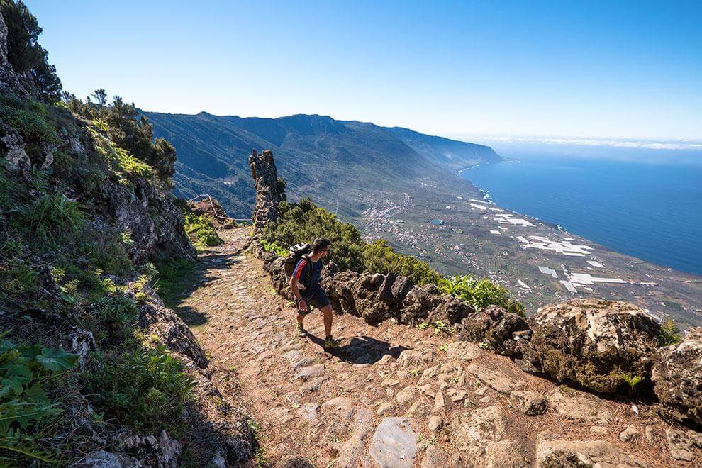
Camino de Jinama (El Hierro)
This eight-kilometer, 885-meter-high route is a difficult challenge, which requires appropriate footwear for trekking, but it is worth hiking because of its geological and botanical value. The trail is divided into two parts: the first is of high difficulty, as it is a cliff that goes up and down; and the second, practically flat, which goes from the chapel of La Caridad to the chapel of San Andrés. The journey takes approximately three hours and follows a historical path that was used as a key route before the road was built in the middle of the last century. There is a stretch where the views are spectacular, and another where the hiker will be able to closely observe the junipers twisted by the trade winds. These are curiously shaped trees gradually shaped into their present form, which seems to revere the visitor.

Duration: 3.5 hours (6 km).
Elevation: 551 meters.
Difficulty level: medium