


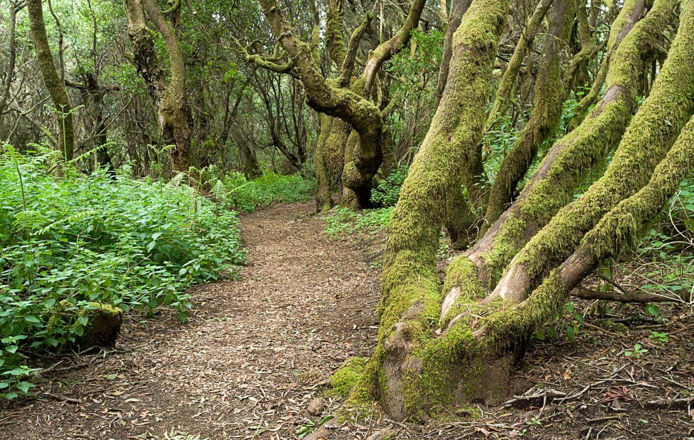
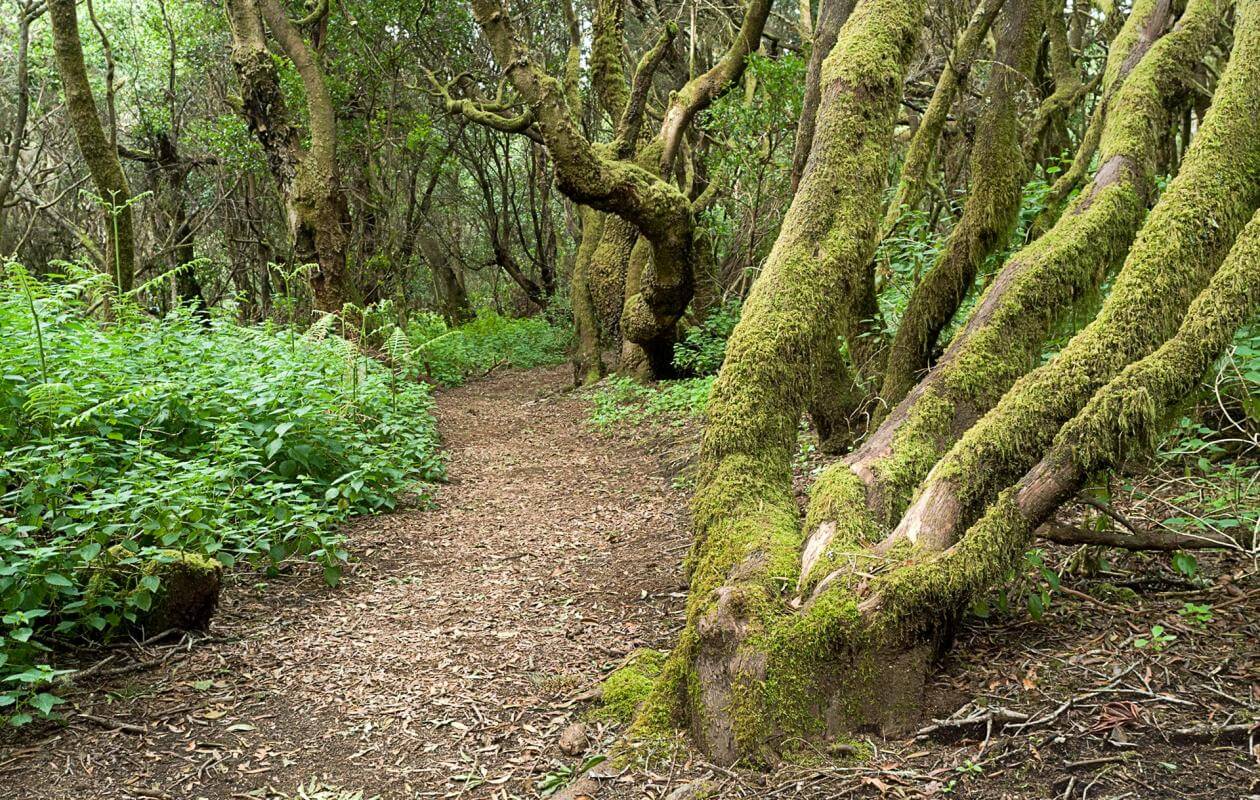

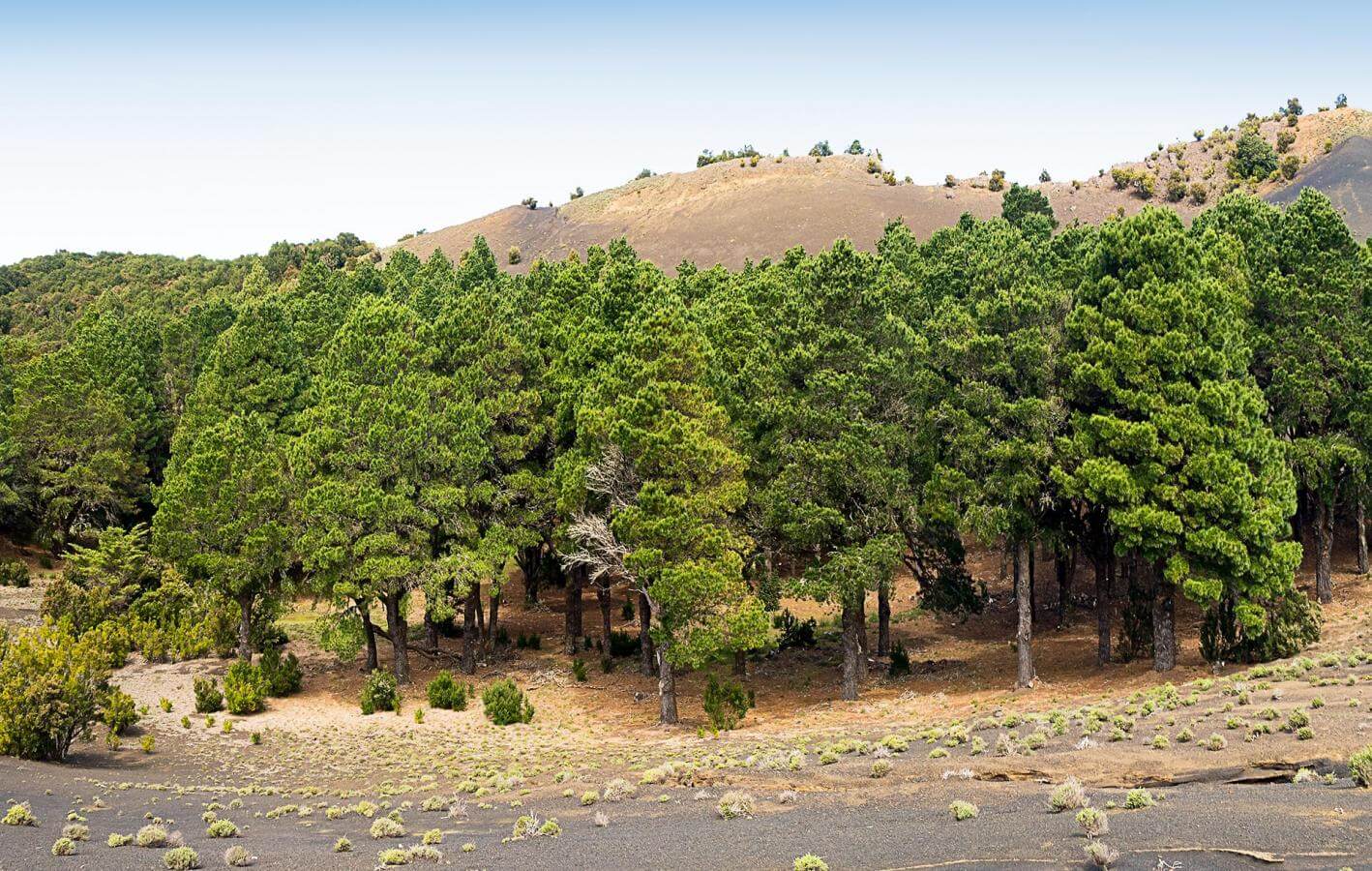


The trail winds through a forest called El Brezal, where paradoxically, the Myrica faya is the dominant species even though the name has been derived from the heather tree. This part of the island receives the highest rainfall, which has led to the proliferation of this forest. You will initially come across a clearing in the forest known as La Chapa Pablo. In this first section of the trail, you will go through a dense laurisilva forest with a closed canopy of foliage and humidity, leading to abundant lichen and moss.
Two imposing Canary pines stand out, reminding us that an evergreen forest on this southern slope continues to be an anomaly, which exists only thanks to the moisture-laden clouds rising up from the El Golfo escarpment.

The trail veers to the south, following the channel of a small, incipient ravine. Since El Hierro is geologically still quite young, the network of ravines is not highly developed. Ferns growing along the trail will catch you attention; the main species being common bracken, also known as the eagle fern.
This is one of the most prevalent species of fern on the island and its fronds can reach up to two metres. The eagle fern can withstand light and some heat and is therefore found in the less humid parts of the forest.

Crossing the highway brings you to Hoya del Morcillo, the main recreational area in the forests of the island. You continue through the forest, though the kind of vegetation changes drastically. The lower humidity leads to heather trees replacing the Myrica faya as they require less moisture and are more resistant to the sun and drought.
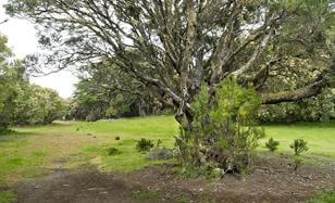
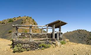
This sizeable glade is located at the base of Montaña de la Fuente. Tablada is a term associated with livestock rearing and thus highlights the importance of this activity in El Hierro. Herds are brought together at the tablada and when it is close to a settlement, this term that was already used in Andalusia, is associated with the abattoirs.
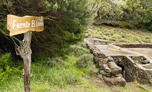
This forgotten source in the forest is part of one of the harshest chapters in the island's history - the post Spanish Civil War period. It was built in the 1940s under the Economic Mandate for the Canary Islands to create a watering hole for livestock. In addition, a cistern was also built, thereby separating human use from that of the herds. This was not that long ago and elders still remember the times when water would be brought from the cisterns to homes in tankers or one had to go to the source to fetch water, often having to wait in a long line to access the little water that the source provided.

In September 2006, a devastating fire burnt down 1,400 hectares of El Hierro's forests. This section of the La Llanía trail goes through an area that was deeply affected by this blaze, which could be brought under control before it climbed up to El Pinar. It is interesting to observe how vegetation in this area is evolving - you have some recovering young Canary pines as also the reforestation of the evergreen vegetation that is slowly but surely taking shape once again.
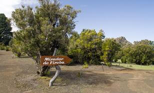
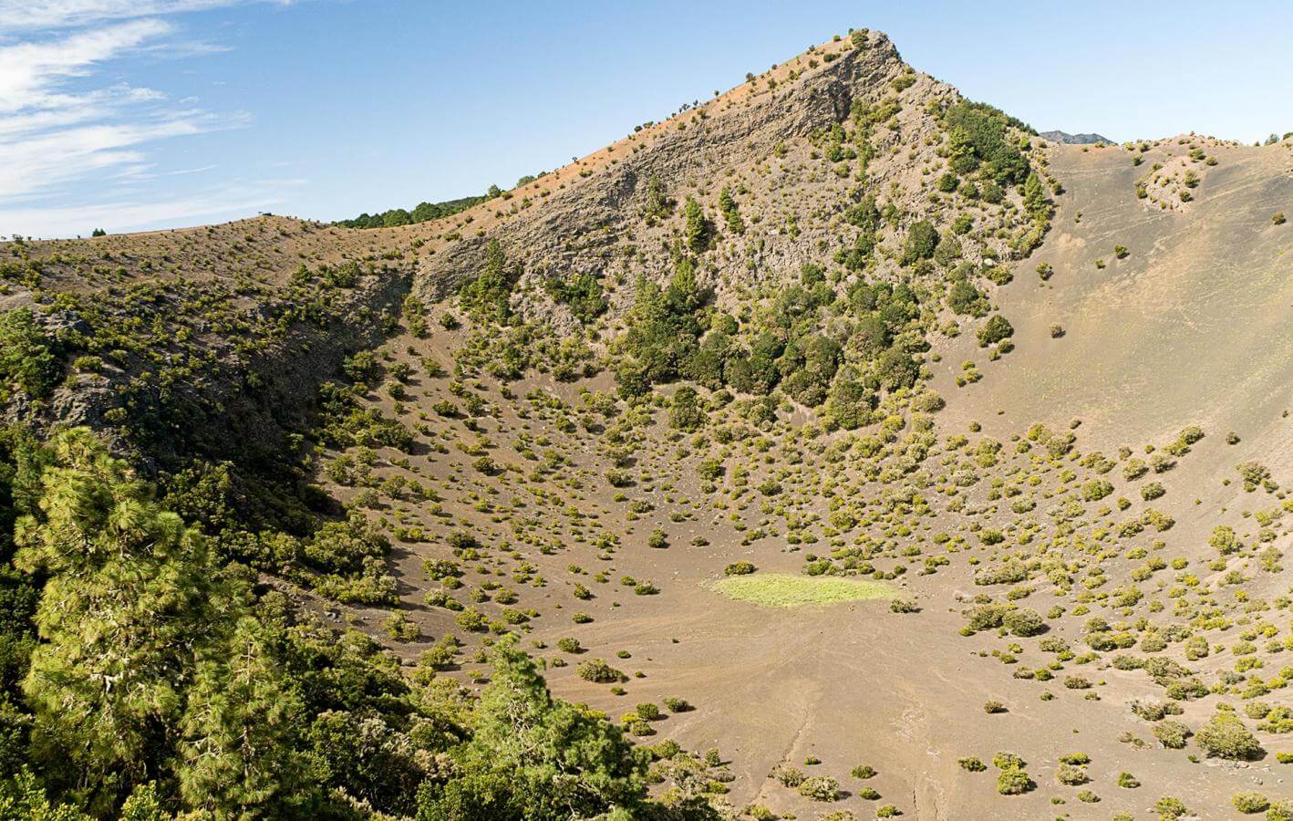
La Hoya de Fireba is a spectacular basin that resulted from a volcanic explosion in the intermediate period of El Hierro's volcanic history. It is also the best-preserved basin on the island, considering there are just three of this type. It is located at the apex of the three ridges that create an irregular star on the island. This impressive crater has an internal diameter of 259 metres, is 110 metres deep and has a flat floor made of volcanic ash.
Entering Hoya de Fireba is quite magical as the interior of the basin continues to be a natural haven, with just the soaring birds to break the silence. The southern face of the crater has an evergreen forest as it receives the trade winds that make it past the El Golfo escarpment, whereas the northern face is practically barren. In the depths of the basin, you have small area that was used to carry out the rain-fed cultivation of potatoes, which can now be accessed thanks to a trail that has been rehabilitated.
This look-out point is located at the southern-most edge of the basin, just above the area where the volcanic ash and lapilli, known on the islands as picón, that were spewed out by the volcano are deposited. To the left of the look-out point, you have Pico de Fireba, which creates a peculiar contrast of colours on humid days. On clear days, you can enjoy an excellent view of the other islands like La Gomera and Tenerife from this look-out point. It is precisely along this southern edge where the look-out point is located that the Camino de la Virgen, the long trail between La Dehesa and Valverde, also passes. Hoya de Fireba lies between the La Llanía and La Mareta rayas, where the Virgen is handed over from one town to the other. In La Llanía, El Golfo hands over to El Pinar, to receive the statue again from Isora in La Mareta.
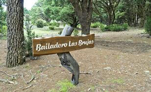
This small flat stretch, which used to be a woody glade before it was reforested, has been linked to the popular belief in witches. It was said that trees did not grow in this area because witches danced here. Magic and its rituals were deeply rooted in the subconscious of the inhabitants of El Hierro and the Canary Islands in general. The areas where witches were said to dance were called bailaderos.
These bailaderos are found on all the islands, however it was also the name given to areas where the original inhabitants would leave their herds without fodder, making them bleat to the Gods and ask for rain.
This is where the name baladero (balar in Spanish means to bleat) comes from and this ended up getting mixed up with witchcraft, leading to the bailadero.
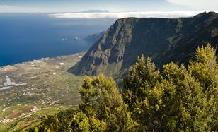
This look-out point is an amazing natural balcony overlooking El Golfo. First off, you will notice the laurisilva at the foothills arching over the walls, which has resulted from an immense landslide that drove a huge portion of the island to the bottom of the sea. El Golfo has resulted from the island being dismantled by gravity - the excessive height led to instability that culminated in an enormous collapse. This has led to extreme cliffs, which like the Tibataje crags are practically vertical and seem to be mirrored in the sea in the form of the Roques de Salmor.
In an area on the left that is less steep, you have the Tanganasoga volcano which contributed to filling up the depression that resulted from the landslide and created the lower area of El Golfo.

This heather tree demonstrates the importance of horizontal rain that results from trapping the humidity from the clouds carried by the trade winds. Like what happens at Garoé, moisture condenses on the branches and leaves and leads to precipitation. The concrete structure below prevents the water from seeping into the ground and instead fills a cistern located at the foot of the tree.
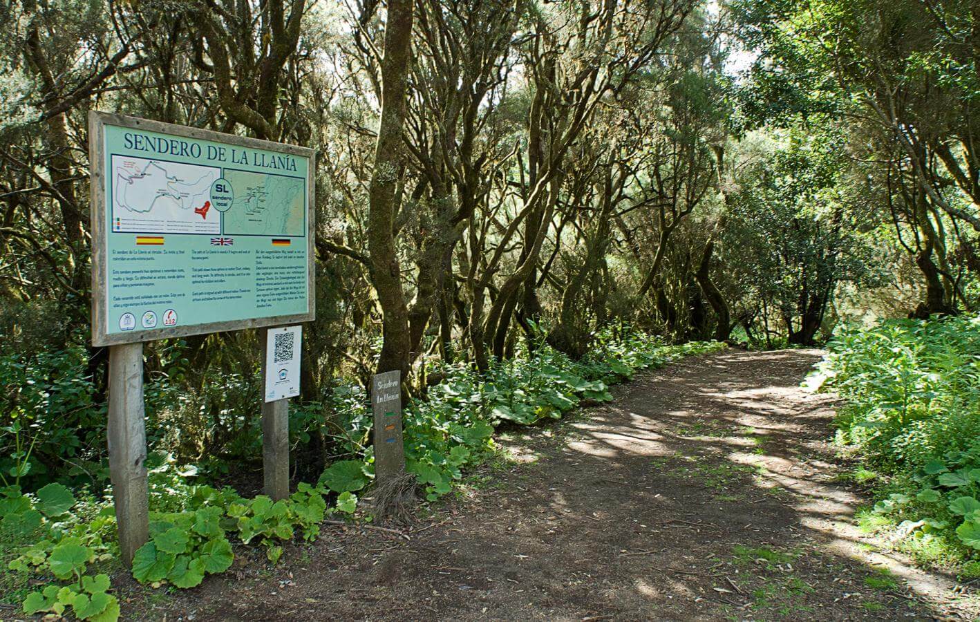
The water that is so ingeniously harvested feeds the Fuente de La Llanía source which serves as the start and now end point of this trail along the northern edge of the Nisdafe plateau. In spite of how small it is, it keeps the 'new source' of La Llanía, where people go to fetch water for their houses, supplied with water throughout the year.
- Respect the animals. Do not bother them or feed them. If you see an injured specimen, you can call the emergency number: 112. Do not pick flowers or plants.
- Do not pick up or take away stones or any other item from the natural environment. And do not move them to pile them up into sadly famous 'towers'.
- Respect the signposting along trails. Leaving the set paths causes damage to the environment and could also be dangerous for you and anyone with you.
- It is safer to keep your pet on a lead.
- Try not to alter the peace of the environment with excessive noise (loud music, yelling, etc.).